Division of Air Quality
Dust Monitoring Network
Our Utah Dust Observation and Research Network (UDORN) offers the unprecedented opportunity to uncover the potential health risks and heavy metal contamination of blowing GSL dust, identifying the source and severity of urban dust deposition, and evaluating the impact of anthropogenic dust on Utah communities.
How the network works
UDORN consists of two types of dust monitoring stations that balance long‑term coverage with flexibility to study specific questions.
Core stations – long‑term neighborhood record
Core stations are permanent monitors providing at least five years of dust data in Wasatch Front Central communities, especially Salt Lake City. UDORN will use 13 core stations that are part of our State and Local Air Monitoring Stations (SLAMS) network, with additional instruments added to monitor dust as PM10.
Satellite stations – flexible study sites
Satellite stations investigate specific dust concerns or research themes and are typically sited for two years as UDAQ Special Purpose Monitors. UDORN will include 10 new satellite stations strategically placed to capture dust impacts from key locations and sources across Utah.
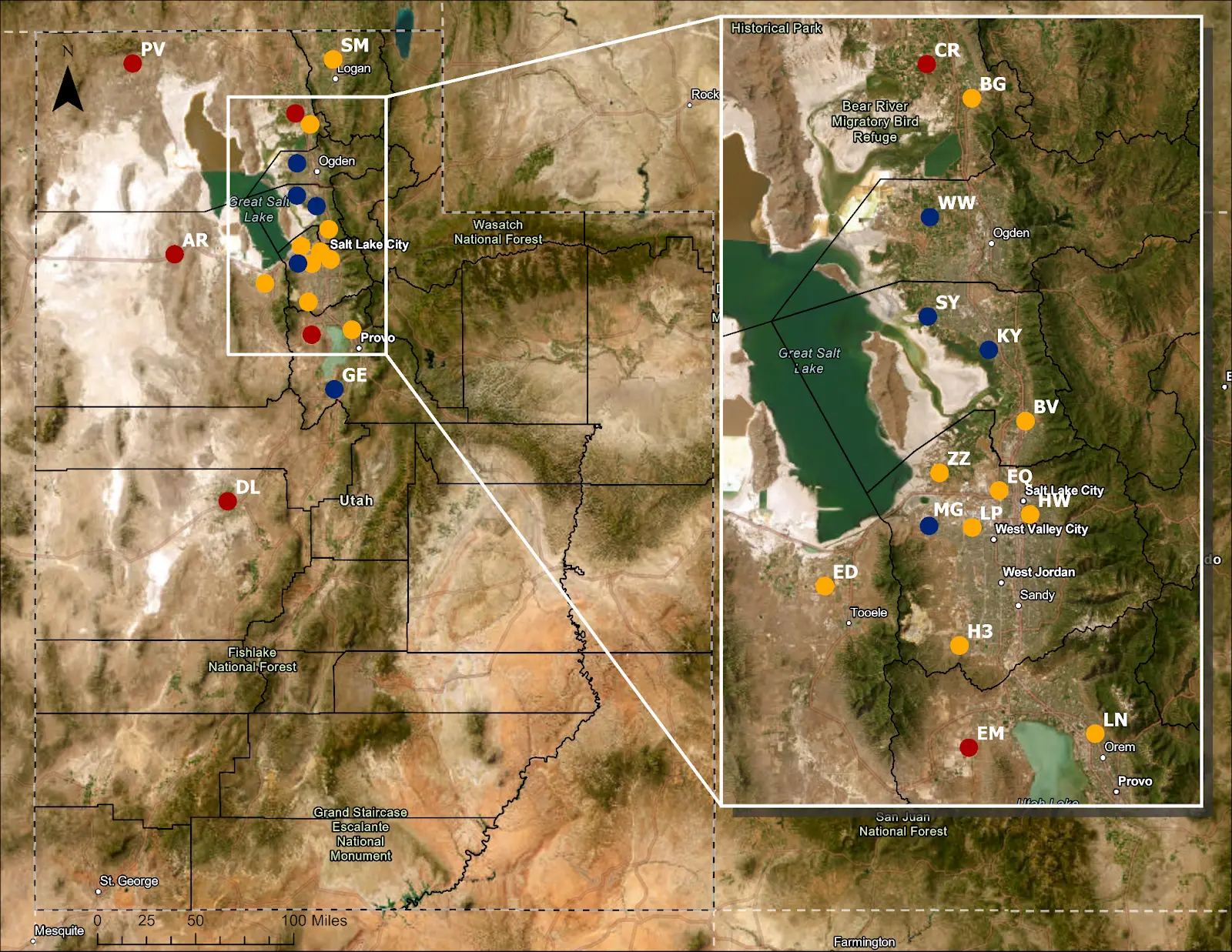
Map of the network
Together, the 20 core and satellite stations allow us to study dust, air quality, and human health across both local and regional scales.
- The yellow circles represent core stations concentrated in communities close to the Great Salt Lake operating for at least five years from 2026–2031.
- The blue circles represent satellite stations positioned to more fully understand Great Salt Lake dust and human-caused dust and will operate from 2026-2028.
- The red circles represent satellite stations to measure regional contributions to Utah’s dust and will operate from 2029-2031.
Three ways we are sharing dust information
UDORN data will be available in its raw form (continuous and particulate particulate matter), as an interactive hoverable map of UDORN displaying summary dust data captured from each station, and as a dust event ledger detailing dust event for each station updated monthly. Links to come soon.
Questions UDORN is aiming to answer
Could Great Salt Lake and nearby dust sources carry harmful heavy metals into communities?
UDORN is designed to uncover the potential public health risks of dust coming from exposed Great Salt Lake lakebed and nearby human‑caused dust sources such as mines, quarries, tailings piles, and degraded rangelands. By measuring dust and analyzing heavy metals in that dust, the network will show how often these sources affect nearby communities and whether they carry concerning concentrations of metals.
How much dust comes from regional deserts and dry lakes?
UDORN also examines how dust from more distant deserts and dry lakes—such as Sevier Dry Lake Playa and parts of the Great Salt Lake West Desert—contributes to dust levels and heavy metal pollution along the Wasatch Front Communities. This work helps distinguish between dust that originates close to the lake and dust that blows in from regional sources, giving a clearer picture of what communities are breathing during different types of storms.
How does UDORN capture dust events?
UDORN will employ three different datastreams to characterize dust during Utah’s dust season (generally mid January through mid October). First, we will capture the size, time, and intensity of dust events with continuous and 48-hour filter sampling from all stations. Second, we will analyze the heavy metal concentrations of dust trapped on filters using Inductively Coupled Plasma Mass Spectrometry to assess the concentrations of heavy metals in dust storms. Third, combining dust data with meteorological data during the event, we will track the origin and trajectory of dust to better understand the impact of dust on the air quality for our residences.
Contact
Rachel Edie
Dust Scientist
[email protected]
Contact for technical inquiries regarding Great Salt Lake dust and other dust research efforts.
Reporting immediate concerns?
If you see dust clouds coming from a construction site, gravel pit, or industrial facility, please use our dust compliance report form.