
Background
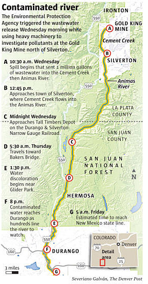
On August 5, 2015, the Environmental Protection Agency (EPA) began clearing material from the opening of the Gold King Mine in Silverton, Colorado, to install a pipe to pump water out of the mine. At 10:30 a.m., the material blocking the tunnel entry suddenly gave way, and a large buildup of water that had collected behind the debris was released into Cement Creek, a tributary of the Animas River.
DEQ, through its Division of Water Quality and Division of Drinking Water, is working with the EPA and other state and federal agencies to assess and monitor the impacts of the Colorado wastewater spill on Utah waterbodies and Utah residents. Additional information is available on the following agency Web pages:
- Colorado Department of Public Health and Environment
- Environmental Protection Agency
- National Park Service: Glen Canyon National Recreation Area
- New Mexico Environment Department
Mine wastewater is a problematic legacy of mining in the West. When mine water comes into contact with pyrite (iron sulfide) that is exposed from mining activities, it reacts with the air and pyrite to form sulfuric acid and dissolved iron. This acid leaches other heavy metals, like copper, lead, and zinc, from the rock. These toxic metals can collect in large pools inside the mines or leak into nearby waterways. With an estimated 55,000 abandoned mines in the western United States, the contamination of rivers and streams from mine water discharge isn’t unique to the Gold King Mine, although it generally does not occur on such a massive scale.
Update March 28, 2019
Yesterday, a federal judge ordered the State of Utah’s lawsuit against three mine owners and one EPA contractor will proceed arising from their roles in causing the Gold King Mine Blowout in August 2015. The resulting massive spill of three-million gallons of toxic mining waste contaminated rivers in Utah, Colorado, New Mexico and the Navajo Nation. Utah and other affected states and private parties assert that the EPA, its contractors, and the mining companies share responsibility for the release of hazardous wastes into the Animas and San Juan Rivers and in Lake Powell, causing one of the largest inland pollution events in the nation’s history.
Update March 21, 2019
A federal judge rejected efforts by Environmental Protection Agency (EPA) contractors to avoid responsibility for their role in causing the 2015 Gold King Mine release, a massive spill of three million gallons of toxic mining waste that contaminated rivers in Colorado, New Mexico and Utah. The companies — Environmental Restoration LLC and Weston Solutions — were EPA’s contractors at the Gold King Mine. Judge William P. Johnson of the U.S. District Court for New Mexico denied the companies’ motions to dismiss lawsuits filed by the states and private parties, rejecting the companies’ arguments that they should not have to pay for the cleanup and environmental damages.
Update March 5, 2019
On March 1, 2019, a federal judge denied the Environmental Protection Agency’s (EPA’s) request to escape liability for the Gold King Mine spill. Judge William P. Johnson of the U.S. District Court for New Mexico denied EPA’s motion to dismiss the lawsuits filed by the states and private parties (174 KB), rejecting EPA’s arguments that it was immune from liability for the cleanup and damages caused by the mine spill.
EPA sought dismissal despite its prior public announcements that it accepted responsibility for the spill and had promised to work with the states to repair the damage. The Court pointed to Utah’s showing that EPA has taken no cleanup action in Utah to date and has no timetable to do so.
The massive spill causing hazardous wastes to be spread along the Animas and San Juan Rivers and in Lake Powell.
Updates November 19, 2018
On November 19, 2018, DEQ finalized a report that summarizes historic and current sediment and water quality data collected and analyzed as a result of the Gold King Mine spill. A fact sheet highlighting the key findings is also available. Please be sure to visit the San Juan Watershed Program page to learn more about projects in the watershed.
- Water Quality and Sediment Analysis Report (73.71 MB)
- Water Quality and Sediment Analysis Report Appendices (147.15 MB)
- Water Quality and Sediment Analysis Fact Sheet (2.67 MB)
Update January 4, 2018
On January 4, 2018, the State of Utah filed an amended complaint in federal district court for damages from the the August 5, 2015, Gold King Mine spill. This amended complaint added the Environmental Protection Agency (EPA) and contractor Weston Solutions as defendants. Utah continues to negotiate with EPA over damages but filed the amended complaint to protect its legal rights.
Update August 11, 2017
State of Utah Files Suit for Gold King Mine Release
On July 31, 2017, the state of Utah filed a complaint in federal district court for damages from the Gold King Mine spill on August 5, 2015.
The state’s lawsuit asserts negligence and other claims on the part of the mine owners and federal contractors and seeks, among other things, to:
- Recover costs incurred by the state from its response to the release.
- Obtain compensatory, consequential, and punitive damages for clean-up, economic loss, and diminished value of the affected natural resources due to the spill.
- Compel the owners of the mines responsible for the mine waste and the EPA contractors to investigate and pay for the cleanup.
- Collect civil penalties for each day the defendants violated the Utah Water Quality Act and Utah Solid and Hazardous Waste Act through their actions.
The EPA has accepted responsibility for the release, and it is not named as a defendant in the complaint. The state is negotiating with the agency to reach a settlement.
Update March 21, 2017
DEQ received $39,055 from the Environmental Protection Agency (EPA) this week, capping off reimbursements for costs the agency incurred during its initial response to the August 5, 2015, Gold King Mine spill.
Reimbursement payments from EPA now total approximately $464,000 and fully compensate DEQ for all reasonable and necessary costs during the initial spill response.
DEQ and the Attorney General’s Office worked closely with EPA to ensure DEQ was reimbursed for its costs during the spill. In addition, the Department coordinated the claims submissions for other state entities who sought to recoup their costs from the spill. EPA reimbursed the Department of Public Safety ($4,473), the Department of Natural Resources ($5,811), the Attorney General’s Office ($4,950), and San Juan County ($19,360) this week, and DEQ will distribute these funds to the recipients.
Water-quality scientists returned to the San Juan River last spring to conduct sampling during the spring runoff. The Water Infrastructure Improvements for the Nation (WIIN) signed into law on December 16, 2016, enacted specific guidelines for response costs eligible for reimbursement, including water sampling and monitoring costs. The WIIN Act bodes well for reimbursement of DEQ’s spring runoff monitoring as well as other eligible response costs.
Update June 21, 2016
Results of DEQ Water Quality Sampling during Spring Runoff
Flow in the San Juan Rivers is high due to spring runoff and approached peak flow conditions on June 5th, 2016. DEQ has evaluated weekly data collected during spring runoff for the months of February, March, April, and the first week of June, 2016. These data were screened against recreational, drinking water, agricultural, and aquatic life criteria. Aluminum concentrations regularly exceed aquatic life criteria at most locations for most sampling events. Total dissolved solids was exceeded in most samples and molybdenum was exceeded once for agricultural uses at the Montezuma Creek monitoring location. No other exceedences of criteria were identified. DEQ will continue to collect samples throughout spring runoff and report results as they become available.
Update May 19, 2016
Results of DEQ Water Quality Sampling during Spring Runoff
The flow in the Animas River and San Juan Rivers are beginning to rise with spring runoff, though they have not yet peaked. DEQ has evaluated the weekly data collected during spring runoff during the months of February, March, April, and the first week of May, 2016. These data were screened against recreational, drinking water, agricultural, and aquatic life criteria. With the exception of aluminum criteria for aquatic life and total dissolved solids for agriculture no other exceedances of criteria were identified. DEQ will continue to collect samples throughout spring runoff and report results as they become available.
Update April 26, 2016
Results of DEQ Water Quality Sampling during Spring Runoff
DEQ has evaluated the weekly data collected during spring runoff during the months of February, March, and the first week of April, 2016. These data were screened against recreational, drinking water, agricultural, and aquatic life criteria. With the exception of aluminum criteria for aquatic life and total dissolved solids for agriculture no other exceedances of criteria were identified.
Continuous Water Quality Monitoring in the San Juan River
DEQ has contracted with USGS to install instrumentation to measure several water quality parameters (turbidity, pH, dissolved oxygen, and specific conductance) in the San Juan River continuously. The data for USGS gage 09379500 (San Juan River near Bluff, UT) are available in real-time at the USGS website. The states of New Mexico and Colorado have similarly contracted with the USGS to install instruments further upstream in the San Juan River and Animas River.
Stakeholder Meeting
A local stakeholder meeting is scheduled for May 20th at 9 AM – 12 PM in Monticello at the Old County Commission Chambers, Administration Building. 117 S Main Street. At the meeting DWQ will present our findings, the long-term monitoring plan, and discuss questions from stakeholders.
Update April 12, 2016
DEQ continues to collect weekly water quality samples in the San Juan River. Thus far, none of the samples collected during spring runoff show exceedances of any screening values for recreational uses, aquatic life, agricultural uses, or drinking water. DEQ will notify the public on this website should any samples exceed any screening values. Otherwise, DEQ will be posting raw and summary data bi-weekly beginning in mid-April.
Update March 21, 2016
DEQ has drafted a Long Term Monitoring and Assessment Plan for the San Juan River and Lake Powell in response to the August 5, 2015 Gold King Mine Spill that occurred in the upper watershed. The Plan consists of 13 tasks that are designed to assess the potential risks to human health, recreation, aquatic life and agriculture.
Update March 4, 2016
The Water Quality Board authorized $200,000 of hardship grant funds to monitor the San Juan River during spring runoff event. There are concerns of a second wave of metal pollution originating from the Gold King Mine release that could be remobilized when the spring melt increases stream flows. The Division of Water Quality is developing a long-term monitoring plan to include:
- monitoring during high flow events;
- placement of instrumentation to provide for continuous monitoring of turbidity; and
- evaluation of the legacy effects of metals released from mines in the San Juan River watershed on Utah’s waters, including Lake Powell sediments.
Update February 10, 2016
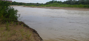
DEQ continues to evaluate the effects of the August 5th release from the Gold King Mine on Utah’s waters. As expected, data indicate that mine waste flowed into Utah and residues will likely continue to move into Utah via solids (sediment) transport especially when river flows increase due to storms, snow melt, and/or dam releases. The leading edge of the contamination released from the Gold King Mine on August 5, 2015 was estimated to cross into Utah via the San Juan River on August 9, 2015. Rainfall and the associated runoff, combined with the increase in flows from the Navajo Reservoir upstream, and dispersion over the hundreds of miles, decreased the ability to detect the precise arrival of the contaminated waters. However, the pollutant concentrations observed during this time period were consistent with the estimates of the contamination arrival in Utah. DEQ has compiled reports on both water column and sediment data collected between August and October 2015. Additional monitoring and investigation will be necessary to further characterize the effects of mine waste releases from the Silverton area on Utah’s waters.
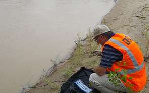
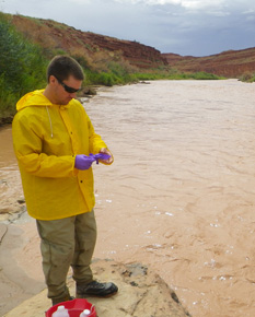
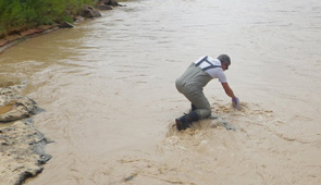
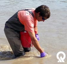
Results of DEQ Water Quality Sampling
DEQ collected water samples at five different locations on the San Juan River. Water samples were collected intensively during the first three weeks of August, 2015 after the Gold King Mine release. Because the acute effects of the release had passed, DEQ moved in September and October to a less intensive monitoring regime. In October, DEQ’s contractor deployed sampling equipment to collect rivers samples during storm events. These samples indicate that the total metals concentration in the river were elevated during the monsoonal storms in late Fall 2015. However, none of the data exceed the recreational health screening values developed by the Utah Department of Health. DEQ also collected a full suite of metals, water column, and macroinvertebrate samples on September 22 and October 26.
DEQ has assembled updated data summary tables with data from August 8, 2015 through October 26, 2015. The Summary Tables provide a full suite of metals, metalloids, and other important water quality parameters from the San Juan River with comparisons to screening values. In addition, the Division of Drinking Water has compared total metals data from drinking water systems regulated by the State of Utah to drinking water standards.
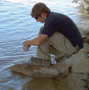
Results of DEQ Sediment Sampling
DEQ has compared concentrations of metals in sediment before the plume’s expected arrival in Utah (August 8, 2015) to three to five samples after the plume’s estimated arrival in Utah. The data are summarized in data tables. None of the samples exceed health screening values. Generally, metal concentrations were higher before the plume at the Stateline site and at Mexican Hat, whereas metals concentrations were higher after the plume at the Montezuma and Sand Island (Bluff) sites. Although there are clear differences between pre- and post-plume data, all of the samples are within the range of sediment metals concentrations recorded historically in the San Juan system (USGS 2014). However, the samples appear to be lower than concentrations of metals found in sediment cores collected historically in the San Juan Arm of Lake Powell. Further evaluation of particle size in both river and lake sediment samples is necessary to determine if these differences are associated with depositional processes or true differences in metals contamination.
Summary of EPA Water Quality Data
On January 28, 2016, DEQ became aware of EPA sampling data that indicated dissolved water concentrations of metals and metalloids exceeded Utah water quality criteria during the September to October sampling period. The EPA data have not been validated, but DEQ has compiled and evaluated the data with review from the Utah Department of Health, Utah Department of Agriculture, and the Utah Department of Natural Resources (see below). DEQ is currently working closely with the EPA and other partners to verify these data and develop a long-term plan to address issues raised by these exceedances.
DEQ compared dissolved metal and metalloid concentrations from the EPA samples against Utah’s water quality criteria (R317-2-14) for domestic source water, warm-water aquatic life, and agricultural uses. The data were also screened against values that are protective of livestock and irrigation. These data revealed several peaks in metal concentrations that exceed the highest concentrations previously observed by DEQ in the San Juan River, including samples collected immediately following the mine release and long-term monitoring records. The exceedances of Utah’s water quality criteria and other screening values are available in a summary prepared by DEQ with review and input from the Utah Department of Health, the Utah Department of Agriculture and Food, and the Utah Department of Natural Resources (Division of Wildlife Resources).
Preliminary evaluations of weather and flow records suggest that at least some of the high concentrations in the data were associated with storm events in the watershed. At present, it is not possible to determine whether these increases in metal concentrations were associated with the recent Gold King incident, historical releases of metals from abandoned mines, or other unknown sources. In any event, it is incumbent on both DEQ and EPA to explore the nature and extent of ongoing metal contamination in this watershed.
Further Investigation
DEQ continues to be concerned about future releases of metals from mines in the San Juan River watershed as well as remobilization of metals deposited in the Animas and San Juan Rivers. DEQ expects to see elevated metal loads in future storm events and especially during the annual spring runoff event. DEQ will resume weekly monitoring to ensure that public health and agricultural uses are not threatened. DEQ also intends to monitor the San Juan River during the upcoming spring runoff event and continue to monitor the drinking water systems that could be influenced by the river for excursions from state and federal standards.
EPA released a draft long-term monitoring plan in September 2015. DEQ provided comments to the draft plan and is working with EPA and other state and tribal partners to develop an appropriate plan to address the questions that have been raised by the sediment and water column data. DEQ met with EPA and other states and tribal authorities on February 5, 2016 to coordinate long-term monitoring efforts. The following goals will guide the development of Utah’s Long-term Monitoring plan, which will be available for public review in Spring 2016.
- Continue to monitor water quality in the San Juan River and regulated drinking water systems to protect public health, livestock, irrigation, and aquatic life.
- Characterize legacy and ongoing mine releases in the San Juan watershed includes mining sources and natural geologic sources.
- Evaluate accumulation of metals in San Juan River and Lake Powell.
- Assess impacts of high metals in sediment and water column on uses of San Juan River and Lake Powell.
Update September 16, 2015
Ongoing Monitoring Efforts
DEQ continues to collect samples and analyze data for metals in the San Juan River system. DEQ collected water column samples daily through August 28, 2015 and moved to a weekly sampling regime on August 31, 2015. DEQ has hired a contractor to assist with these efforts. Weekly samples include water column (total and dissolved metals), sediment (total metals), and macroinvertebrate (total metals) samples at five sample locations along the river. DEQ’s contractor will also collect samples during the next large storm event in the area to evaluate whether sediment becomes remobilized and moves additional metals into Utah. DEQ continues to develop a long-term monitoring and assessment strategy. The final strategy will be largely informed by the strategies currently under development by EPA and other federal partners.
Water Quality Sampling Data
DEQ has assembled updated data summary tables with data from August 8, 2015, through August 20, 2015. DEQ will update these tables to reflect data collected since August 20, 2015, as soon as they are available.
The Screening Value Table provides a full suite of metals, metalloids, and other important water quality parameters. These screening values can be used for a variety of toxicological or risk assessment purposes. Due to the preliminary nature of these results, DEQ presents the values as early indicators that may require further examination. Interpretation of these tables was provided by the Utah Department of Health for drinking water and recreation in a Statement of Evaluation.
These data are provisional and subject to change and are undergoing DWQ’s quality assurance and quality control procedures. Data are released in the interest of providing timely data to the public and neither DWQ nor the State of Utah may be held liable for any damages resulting from its use.
Sediment Sampling Data
DEQ has compared concentrations of metals in sediment before (August 8, 2015) and after (August 18, 2015) the plume. The data are summarized in data tables. None of the samples exceed health screening values, as discussed in the Statement of Evaluation provided by the Utah Department of Health. Generally, metal concentrations were higher before the plume at the Stateline site and at Mexican Hat, whereas metals concentrations were higher after the plume at the Montezuma and Sand Island (Bluff) sites. Although there are clear differences between pre- and post-plume data, all of the samples are within the range of sediment metals concentrations recorded historically in the San Juan system (USGS 2014). Additional data gathered last week and this week will help DEQ to determine if the changes observed between pre- and post-plume samples represent a trend.
Update August 19, 2015
Preliminary Analysis of Immediate Effects
DEQ has prepared a summary of its analysis of the immediate, short-term effects of the Gold King Mine release on Water Quality in the San Juan River, Utah. This interpretation may change as additional data and information continue to be collected and interpreted.
DEQ scientists believe that the highest levels of contaminants associated with the initial spill event have passed through the San Juan River in Utah. DEQ makes this statement based on several considerations:
- At all monitoring locations, the dissolved concentrations of key dissolved metals have peaked and subsequently declined to concentrations reflective of historic data and that are below established environmental screening levels.
- Total metals concentrations are highly variable and difficult to interpret with respect to this event.
- The monsoon storm events that occurred over the last couple of weeks are characteristic, but complicate interpretation of monitoring results, especially with respect to total metals.
- It is not currently possible to address all possible future states because the long-term effects of observed peaks remain unknown.
- Over the long-term, any metals from the event that arrive in Utah will ultimately be deposited in Lake Powell. DEQ discusses its consideration of these long-term effects later in this analysis.
DEQ’s analysis includes examination of data collected by DEQ monitoring staff following the spill at four sites along the San Juan River twice daily from Saturday, August 8 to Tuesday, August 11, 2015, and then once daily through Monday, August 17, 2015. DEQ has also reviewed data collected by the New Mexico Environment Department and the U.S. Environmental Protection Agency (EPA) on the San Juan River upstream of Utah and also compiled and evaluated historic data collected by DEQ and the U. S. Geological Survey (USGS) beginning in the late 1970’s to place recent results in context with respect to the range of conditions observed historically.
Estimated Plume Arrival in Utah
DEQ scientists predicted the date and time of the leading edge of the plume by comparing the discharge measured at four USGS gages against field measurements of river velocity. The discharge-velocity relationships allowed DEQ scientists to estimate the most likely time that the plume reached monitoring stations on the San Juan River.
DEQ estimates that the plume arrived near the Utah-New Mexico border between August 9, 2015, at 8:30 p.m. and August 10, 8:30 a.m. and at Lake Powell on August 15, 2015, between 5:00 a.m. and 5:00 p.m.
Expected Plume Signature in Utah
The preliminary screen of priority pollutants to use as sentinels for this event revealed two principal dissolved metals that could be used to trace the plume, if evident, through Utah:
- Aluminum
- Iron
An additional three metals were identified as complimentary tracers because they were a significant component of the mine release, but at much lower concentrations:
- Manganese
- Zinc
- Cobalt
Analysis of Trends in Water Quality Data
DEQ has prepared time-series plots (Appendix 1) that show the concentrations of water-quality parameters through time at four separate sampling locations. The data include samples collected by both DEQ and EPA.
Dissolved Metal Trends Linked to the Plume
The peaks of tracer elements like aluminum and iron occurred first at samples collected at the Utah-New Mexico border and then progressively later at downstream locations. The box plots (Appendix 1) accompanying the time-series plots also reveal that peaks in dissolved aluminum and iron were greater than concentrations observed from historical routine monitoring in the San Juan River. Observed peak concentrations of these key metals persisted, depending on the monitoring location, from about 12-24 hours, although precise estimates of the extent of dispersion of the plume are immediately impossible to determine due to the 12-hour lag between samples.
Total Metal Patterns in the River Difficult to Link to Plume
DEQ was not able to use patterns in total metals concentrations to evaluate the effects of the release on the San Juan River. Total metals interpretation was complicated by high background concentrations, storm and natural geology influence, the potential for laboratory interference, and sedimentation and remobilization processes.
Screening Values for River Uses
The most important immediate question related to the Gold King Mine release on Utah’s waters is whether any observed increases in metals concentrations pose a threat to the uses of the San Juan River. DEQ has addressed this concern by collaborating with Utah’s Department of Health (UDOH) and Utah Department of Agriculture and Food (UDAF) to establish threshold values and appropriate ways for interpreting these values for those uses that were determined to be at greatest threat from this event. These tables and associated indicator values have been published daily until monitoring efforts associated with this event cease. These ongoing results continue to be evaluated with respect to the threat that elevated concentrations potentially pose to several important uses of the San Juan River:
- Drinking Water
- Recreation
- Fish and Wildlife
- Agriculture
Generally, professionals from all state agencies have concluded that, even at peak concentrations, the observable increase in metals from the Gold King Mine release have posed minimal threat to all of these uses.
Long-term Effects
Over the long-term, DEQ scientists project that most metals from the Gold King Mine release that arrive in Utah will ultimately be deposited in Lake Powell. Ideally, these metals will be covered by a sufficient layer of non-toxic sediment to reduce aquatic life exposures to high metal concentrations. The high sediment load of the San Juan River, the depositional area in the San Juan arm of Lake Powell, and the long residence-time of water and its constituents in the lake before being transported downstream (roughly 7.2 years), should help reduce the effects of this event. Many questions regarding the long-term impacts of this spill remain unanswered. For example, impacts of the contamination on nearby groundwater drinking water aquifers, aquatic ecosystems, and soils irrigated with river waters are just a few of the many potential issues that will need to be addressed. These issues will require that DEQ, in collaboration with other Utah agencies, develop a long-term monitoring plan.
Sampling Data
DEQ has assembled updated data summary tables with data from August 8, 2015, through August 18, 2015. DEQ will update these tables to reflect data collected on August 19, 2015, as soon as they are available.
The Screening Value Table provides a full suite of metals, metalloids, and other important water quality parameters. These screening values can be used for a variety of toxicological or risk assessment purposes. Due to the preliminary nature of these results, DEQ presents the values as early indicators that may require further examination. Interpretation of these tables was provided by the Utah Department of Health for drinking water in the Statement of Evaluation. The Utah Department of Agriculture and Food has evaluated the data for agricultural uses and lifted any advisories against using San Juan River water for crop irrigation and livestock watering.
These data are provisional and subject to change and are undergoing DWQ’s quality assurance and quality control procedures. Data are released in the interest of providing timely data to the public and neither DWQ nor the State of Utah may be held liable for any damages resulting from its use.
Update August 17, 2015
Sampling Data
DEQ has assembled updated data summary tables with data from August 8, 2015, through August 15, 2015. DEQ will update these tables to reflect data collected on August 16, 2015, as soon as they are available.
The Screening Value Table provides a full suite of metals, metalloids, and other important water quality parameters. These screening values can be used for a variety of toxicological or risk assessment purposes. Due to the preliminary nature of these results, DEQ presents the values as early indicators that may require further examination. Interpretation of these tables was provided by the Utah Department of Health for drinking water in the Statement of Evaluation. The Utah Department of Agriculture and Food has evaluated the data for agricultural uses and lifted any advisories against using San Juan River water for crop irrigation and livestock watering.
These data are provisional and subject to change and are undergoing DWQ’s quality assurance and quality control procedures. Data are released in the interest of providing timely data to the public and neither DWQ nor the State of Utah may be held liable for any damages resulting from its use.
Comparison of San Juan River Raw Water Data with Finished Drinking Water Screening Values – Total Metals
The total metals analysis provides results for metals that are both dissolved and present as very small particles. This result is considered more protective of public health because the sampling data show both the dissolved and particle form of each metal tested.
In addition to the environmental screening levels, DEQ’s Division of Drinking Water (DDW) also compared the measured levels of total metals and dissolved metals from the San Juan River water samples to the EPA-established drinking water Maximum Contaminant Levels (MCLs) for metals. For drinking water quality, it is more protective of public health to use the total metals result to determine how safe water is to drink. Because of this, MCLs are compared against the total metals analysis when treated waters are assessed for safety.
The sampling results from August 8, 2015, through August 15, 2015, so far indicate that:
- The total metals in the untreated river water samples have exceeded the drinking water MCLs for aluminum, arsenic, iron, manganese, and the action level of lead.
- The dissolved metals in the untreated river water samples meet these drinking water MCLs.
Therefore, it is likely that the suspended particles in the river water contributed to the MCL exceedance of aluminum, arsenic, iron, manganese, and lead.
Drinking water systems that can properly treat surface water and meet the required turbidity standards established by the EPA can successfully remove the suspended particles during the water treatment process. As the dissolved metals data meet MCLs, DDW finds that the San Juan River can be a viable water source if adequate treatment (e.g., filtration, precipitation, etc.) exists to remove the suspended particles and to meet turbidity standards.
DEQ continues to coordinate with three San Juan County water systems regulated by the State of Utah (Mexican Hat, Bluff, and Sand Island) in regards to monitoring the public drinking water wells located near the San Juan River. It is important to note that none of these three water systems draw their source waters directly from the San Juan River. Mexican Hat’s long-term monitoring strategy includes taking metals samples from its wells this week and continuing periodic metals sampling as needed beginning in six months’ time. The compliance sampling data for all public water systems regulated by State of Utah are available from DDW. To obtain the data from DDW, fill out the request form and fax the form to (801) 536-4211.
Public water systems located on tribal lands are being managed by their appropriate authorities such as the Navajo Tribal Utility Authority (NTUA).
Residents with a private well can call a certified drinking water lab to get it tested.
Update August 15, 2015
DEQ has assembled updated data summary tables with data from August 8, 2015, through August 14, 2015. DEQ will update these tables to reflect data collected on August 15, 2015, as soon as they are available.
The Screening Value Table provides a full suite of metals, metalloids, and other important water quality parameters. These screening values can be used for a variety of toxicological or risk assessment purposes. Due to the preliminary nature of these results, DEQ presents the values as early indicators that may require further examination. Interpretation of these tables was provided by the Utah Department of Health for drinking water in Statement of Evaluation. The Utah Department of Agriculture and Food has evaluated the data for agricultural uses and lifted any advisories against using San Juan River water for crop irrigation and livestock watering.
These data are provisional and subject to change and are undergoing DWQ’s quality assurance and quality control procedures. Data are released in the interest of providing timely data to the public and neither DWQ nor the State of Utah may be held liable for any damages resulting from its use.
Update August 14, 2015
Sampling Data
DEQ has assembled updated data summary tables with data from August 8, 2015, through August 13, 2015. Users should note that the data reported for August 13, 2015 are partial data. DEQ will be receiving additional data over the weekend for samples taken on August 12, 2015, and August 13, 2015, and will update the tables to reflect these data as soon as possible.
The Screening Value Table provides a full suite of metals, metalloids, and other important water quality parameters. These screening values can be used for a variety of toxicological or risk assessment purposes. Due to the preliminary nature of these results, DEQ presents the values as early indicators that may require further examination. Interpretation of these tables was provided by the Utah Department of Health for drinking water and by the Utah Department of Agriculture and Food for agricultural uses.
These data are provisional and subject to change and are undergoing DWQ’s quality assurance and quality control procedures. Data are released in the interest of providing timely data to the public and neither DWQ nor the State of Utah may be held liable for any damages resulting from its use.
Health Effects
The Utah Department of Health (DOH) reviewed DEQ’s data collected on August 11, 2015 and prepared a Statement of Evaluation for these data.
Agricultural Effects
The Utah Department of Agriculture and Food (UDAF) is lifting any advisories against using San Juan River water for crop irrigation and livestock watering.
Based on the latest DEQ evaluation of the San Juan River water sample data, Utah State University’s veterinary toxicologist reports that the river’s highest levels of contamination posed no adverse effects on plants, soils and animals, only short-term and minimal exposure risks. The UDAF advises farmers and ranchers to remain cautious and report any changes in the health of their crops and livestock.
Estimate of Plume Arrival in Utah
DWQ hydrologists have estimated the most probable arrival time of the leading edge of the Gold Mine Spill plume into Utah as well as each of the DEQ monitoring stations along the San Juan River. Scientists analyzed the flow and velocity at USGS continuous flow gages along the San Juan and Animas Rivers as well as the observed arrival time of the leading edge to the San Juan River as reported by agencies in Colorado and New Mexico.
The estimated arrival time for each station was bracketed by six hours before and after expected arrival to account for uncertainty in the estimates. Based on these new calculations, DEQ scientists estimate that the plume first arrived in Utah somewhere between 8:30 p.m. on Sunday, August 9, 2015, and 8:30 a.m. on Monday, August 10, 2015. These estimates also suggest that the plume first arrived in Lake Powell somewhere between Wednesday night (August 12, 2015) and Thursday morning (August 13, 2015).
It is not currently possible to determine the extent to which the plume was dispersed, and DWQ scientists will continue to evaluate data over the weekend with the hope of shedding light on this question. Arrival estimates for all sites are shown on a map and in tabular format below and are reflected in the summary data tables.
DEQ scientists continue to evaluate water quality and hydrologic data for samples collected along the San Juan River. Analysis of trends in metals concentration, coincident with estimated timing of the plume arrival, will be provided as soon as it is complete.
| Location | Sample Location | Earliest Estimated Arrival | Latest Estimated Arrival |
|---|---|---|---|
| Near Stateline | San Juan River @ US 160 Crossing in CO | 08/09/15 @ 8:30 PM | 08/10/15 @ 8:30 AM |
| ~30 Miles from Border | San Juan River @ Town of Montezuma | 08/10/15 @ 9:30 AM | 08/10/15 @ 9:30 PM |
| ~25 Miles from Montezuma | San Juan River @ Sand Island | 08/10/15 @ 7:00 PM | 08/11/15 @ 7:00 AM |
| ~30 Miles rom Sand Island | San Juan River @ Mexican Hat US 163 Xing | 08/11/15 @ 5:00 AM | 08/11/15 @ 5:00 PM |
| ~75 Miles from Mexican Hat | Lake Powell, San Juan Delta | 08/12/15 @ 5:00 AM | 08/12/15 @ 5:00 PM |
| ~160 River Miles from the Border |
Update August 13, 2015
Sampling Data
DEQ has assembled a series of tables that summarize data collected from the San Juan River in response to the Gold King Mine spill.
The Screening Values Table provides a full suite of metals, metalloids, and other important water quality parameters. These screening values can be used for a variety of toxicological or risk assessment purposes. Due to the preliminary nature of these results, DEQ presents the values as early indicators that may require further examination. Additional tables present laboratory data for drinking water (total metals and dissolved metals), agriculture, and aquatic wildlife. Drinking water exceedances were further evaluated by the Department of Health.
These data are provisional and subject to change and are undergoing DWQ’s quality assurance and quality control procedures. Data are released in the interest of providing timely data to the public, and neither DWQ nor the State of Utah may be held liable for any damages resulting from its use.
Health Effects
The Utah Department of Health (DOH) reviewed DEQ’s data collected on August 10, 2015 and prepared a Statement of Evaluation for these data.
The data showed that for public use, six contaminants exceeded screening values: aluminum, arsenic, barium, iron, lead, and manganese. For each contaminant identified above the screening level, a 95 percent upper confidence limit (95% UCL) was calculated. This value represents with 95 percent confidence that it is above the true average concentration for the contaminant in the environment that is being sampled and more accurately depicts what a person will come into contact with rather than simply using a simple average or a maximum value.
After calculating the 95% UCL, this value is compared to the health-based screening values. If it falls below the screening value, no further exposure investigation is warranted. For this data set, the 95% UCL for barium fell below screening levels and was not evaluated further.
The five remaining contaminants that exceeded screening levels were evaluated for recreational exposures. DOH defines a standard recreational exposure as 60 days of exposure per year for two hours a day. It considers skin contact and accidental ingestion of river waters during recreation of 50 mL per hour.
None of the contaminants exceeded screening values for agricultural use.
Based on these data, DOH does not expect that recreational or agricultural use of the San Juan River will result in adverse effects in people, livestock, or crops. It is still recommended that recreational users carry their own drinking water and not rely on filtering or purifying river waters. Further evaluations and updated findings will be provided as new data become available.
Long-term Impacts
DEQ scientists are evaluating the potential long-term risk to Utah’s waters from the release of more than two million pounds of toxic metals into the Animas River. A number of factors mitigate the effects of the spill in Utah, and these factors help explain why the levels of metals in Utah have been difficult to link directly to the spill:
- The underlying chemistry in western streams creates conditions that cause most metals to settle from the water or otherwise be retained upstream. The chemical environment of these rivers should cause iron—about 85 percent of the metals that were released in the spill—to settle relatively quickly.
- Alkaline conditions in the Animas and San Juan Rivers and the large quantities of sediment that move through these systems mean the metals are likely to remain attached to particles and not pose acute risks to aquatic life or people.
- The total volume of water released constitutes less than 1 percent of the daily flow in the San Juan River. The relative threat of exposure to toxic metals diminishes as these metals become diluted and dispersed in the water.
- The higher flows in the San Juan River, due to the size of the river and intentional releases from Navajo Dam following the mine discharge, should help reduce exposure to the toxins released from the Gold King Mine. Recent storms in southern Utah further reduced any immediate threats.
- The San Juan River carries large amounts of sediment downstream, which should help bury any metals that make it to Lake Powell, minimizing the potential for these substances to negatively affect the fish and other wildlife that use the lake.
Once these metals have settled, DEQ will begin evaluating the long-term impacts to Utah’s San Juan River and Lake Powell and will partner with other agencies to develop long-term monitoring plans.
Update August 12, 2015
Preliminary results from water quality samples taken by DEQ on August 8, 2015, and August 9, 2015, along the San Juan River show low levels of metals dissolved in the water and, as expected, higher levels of total metals in the sediment being carried by the river.
Total metals analysis for water samples include the metals content both dissolved in the water and present in the particulates in the water
Sediment in the San Juan River naturally contains higher levels of metals. Scientists believe the high concentrations of total metals in the initial sampling are attributable to the suspension of sediment containing metals from weekend flooding. DEQ is currently evaluating existing water quality data from upstream to help determine the impact the recent storms have had on river quality.
Based on the reported upstream location of the leading edge of the plume on Saturday, the velocity of the river, and the expected slower velocity of the metals-laden plume, DEQ scientists can’t say with certainty the location of the plume, but it appears to have been completely assimilated into the waters of the San Juan River.
DEQ is committed to providing ongoing sampling data in a timely fashion, but cautions again that these data and conclusions are preliminary and may change as additional information becomes available. Additional results followed by analyses will be posted as soon as they are available.
The Utah Department of Health (DOH) has reviewed the preliminary data and compared them to human health screening values. The data for all of the analytes except aluminum, arsenic, manganese, lead, and iron were below the health screening values.
The five metals that were measured at concentrations above the screening values were further evaluated for potential exposure during recreational use, which is 60 days of exposure for two hours a day and the accidental ingestion of 100 ml of river water. Based on this evaluation, DOH does not recommend any additional precautions for recreationists beyond not using San Juan River water for drinking and washing after contact with the river as soon as possible.
The Agency of Toxic Substances and Disease Registry (ATSDR) has prepared fact sheets for arsenic, lead, manganese, and aluminum that answer frequently asked health questions for four of the five metals that were measured at concentrations above the screening values. ATSDR has not developed a fact sheet for iron oxide due to its benign nature.
Update August 11, 2015 (P.M.)
DWQ scientists and local health department officials continue to collect water samples at the four locations on the San Juan River. While the plume was expected to have crossed into Utah yesterday, DWQ scientists report that they have not observed any changes in the color of the river. Samples taken at 8:50 a.m. this morning at the Utah border showed pH values of 8.1 at the Utah border and 8.2 at Mexican Hat, unchanged from the previous days.
If the contaminated plume has in fact arrived in Utah as predicted, the pH data suggests that natural processes in the San Juan River have neutralized the plume’s acidity. It is important to note that at higher pH values, such as pH 8, metals such as copper, cadmium, lead, and zinc are less soluble and more likely to settle as sediment. This means the metals are less bioavailable (able to be absorbed by the body).
DWQ is processing water samples to analyze for total metals (dissolved plus undissolved) and dissolved metals. A dissolved metals analysis of a water sample removes the particulates with a filter and analyzes the filtered water for metals. Analyzing for both total metals and dissolved metals helps to ensure that the plume will be detected even if most of the metals have switched from dissolved to undissolved.
The metal results for pre-plume background samples are expected this afternoon, and results for potential plume-impacted samples will arrive no earlier than Wednesday afternoon. In the meantime, DWQ continues to coordinate with the Utah Department of Health and the San Juan County Department of Health to provide information for people using San Juan River water. At this time, the San Juan County Department of Health recommends that river recreationists bring their own drinking water and not use river water until data are available to confirm that pollutants in the river are at acceptable concentrations for drinking.
Update August 11, 2015 (A.M.)
Sampling
DWQ sampling for pH values yesterday showed the levels are holding steady, ranging from 8.06 to 8.20, which is similar to background conditions. Aerial and ground reconnaissance indicates that the plume associated with the release has dissipated downstream, and there is no leading edge of contamination visible in downstream sections of the San Juan River or Lake Powell.
The Utah Division of Wildlife Resources (DWR) is collecting fish samples in Lake Powell to establish baseline metals levels in fish before the plume arrives at the lake.
The Navajo Nation EPA (NNEPA) surface water monitoring program collected water and sediment samples from the San Juan River prior to the spill impact. EPA contractors are coordinating and conducting sampling and lab analysis in conjunction with NNEPA. The joint EPA/NNEPA river sampling program is focused on the San Juan River between the Shiprock/Hogback, New Mexico area and Mexican Hat, Utah. Sampling will continue for the foreseeable future.
Health and Wildlife
EPA has compared the surface water quality data it collected on August 5-6, 2015 to EPA screening levels for human health. The screening levels for human incidental water ingestion during recreation are based on an exposure duration totaling 60 days, 8 hours a day. The State of Colorado has developed screening levels for agricultural exposure based on an exposure duration totaling 30 days. Based on the data seen so far, EPA and the Agency for Toxic Substances and Disease Registry (ATSDR) do not anticipate adverse health effects from exposure to the metals detected in the river water samples from skin contact or unintentional ingestion. Similarly, the risk of adverse effects to livestock from ingestion or skin contact with metals detected in river water samples is low. It is still advisable to avoid areas with orange discoloration in the river water.
The assessment of impacts to wildlife and fish populations is ongoing. To date, EPA has seen no indication of widespread fish mortality in the Animas or San Juan rivers. Fish cages placed directly in the Animas River by the State of Colorado Division of Parks and Wildlife for two days resulted in one mortality out of 108 fish tested. The State of Colorado will continue to evaluate fish mortality and other ecological impacts going forward.
EPA is also working with the New Mexico Department of Game Fish and the U.S. Fish and Wildlife Service (FWS) to investigate reports of impacts to wildlife. FWS has requested that EPA contract with a wildlife rehabilitation to assist with cleaning animals, if necessary, with the FWS providing capture and oversight of the operations for the state.
Navajo Nation Drinking and Irrigation Water
The President of the Navajo Nation has declared a State of Emergency for the San Juan River valley. Navajo officials have assessed their well fields and drinking and irrigation water intake systems and issued a precautionary “do not use” public service announcement regarding water from potentially impacted sources. NNEPA requested drinking water sampling support immediately for Navajo-operated water intakes. NNEPA and EPA drinking water experts will inventory and assess water sources, including private wells and intakes. The EPA will be providing assistance to the Navajo Tribal Utility Authority (NTUA) to deliver water to the areas impacted by the spill, starting with the Montezuma Creek area. NTUA is sourcing the water from their Sweetwater wells and filling up the service tanks in the affected areas.
Update August 10, 2015 (P.M.)
Turbid water conditions in the San Juan River made it difficult for DWQ scientists to tell if the spill plume entered Utah today. Field values from sites that were sampled today showed the pH of the water ranged from 8.0 to 8.1, which is similar to normal background conditions. By comparison, pH values near the spill site were acidic, ranging from 3.74 to 4.68 after the mine water release.
DWQ will receive test results tomorrow from the samples that were taken by division scientists on August 8-9, 2015. Data from these tests will show baseline levels of metals, total suspended solids, and dissolved solids in the San Juan River and will be used as comparison points for any changes that might be observed once the spill plume mixes with river water.
Update August 10, 2015 (A.M.)
The Division of Drinking Water (DDW) has assessed the drinking water sources and systems regulated by State of Utah and determined that they should not be affected by the San Juan River contamination. DDW has been in communication with Bluff, Mexican Hat, and the Sand Island BLM boat launch and camp groundwater systems. These water systems have drinking water wells located near San Juan River. None of these water system has any surface water intake directly from the River. Bluff and Mexican Hat are actively monitoring their wells, and DDW is following the situation closely.
DDW has been in touch with the Navajo Tribal Utility Authority (NTUA) regarding drinking water systems not regulated by State of Utah that could be impacted by the spill. According to NTUA, the Aneth water system is in normal operation. Water for its well comes from the formation, so it is not affected by the river. Montezuma Creek’s well was taken off line because there were concerns about the influence of the river on well water. The Montezuma Creek water system’s distribution system is in normal operation and has three days of water storage from the tanks.The Halchita water system has been receiving hauled water for a week to its storage tank from the Oljeto and Douglas Mesa water systems. Halchita has shut down its river-water intake.
All drinking water needs in the NTUA water systems are being met. There is no conclusive information at this time regarding agriculture or stock watering needs.
Update August 9, 2015
(Dave Ariotti, DEQ)
This evening, the EPA revised its estimate of the amount of mine water released upwards from 1 million gallons to 3 million gallons on the basis of data collected from a U.S. Geological Survey (USGS) stream gage on Cement Creek. The EPA has opened up two additional settling ponds near the mine portal to treat the mine water discharges. The mine water is being treated in a series of settling ponds constructed near the portal and the treatment appears to be effective. EPA is adding lime and sodium hydroxide solution to facilitate sedimentation of the metals in the pond, which will lower the pH (acidity) of the water and adding flocculent to increase the amount of sedimentation. The treated water discharged to Cement Creek has a pH of 5.5.
The Division of Water Quality (DWQ) had a crew with a pH meter at the state line today waiting for the plume, which officials are unsure when it will arrive. DWQ collected metals samples and pH readings at the state line at 12 p.m., 3 p.m., 6 p.m., and 9 p.m. The division will transport these samples to Salt Lake City early Monday morning for analysis and expects to have data to report by Tuesday.
DWQ has sondes (water quality monitoring instruments) in the river measuring continuous pH at Montezuma, Sand Island, and Mexican Hat. Water quality scientists were not able to deploy a continuous instrument at the state line site.
Beginning tomorrow, DWQ will collect water column samples at all four sites, once in the morning and again in the afternoon. Division scientists will continue this sampling regime until at least Friday.
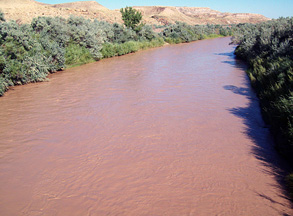
Samplers in Shiprock, New Mexico, have been in discussions with the USGS, and they report that the pH readings at Shiprock indicate that the dilution of the mine water has buffered the pH levels so the water is no longer acidic. The river is very turbid due to rains and is currently red-colored. DWQ’s sampling crew does not believe they will be able to see the plume when it arrives in Utah due to this turbidity.
Mexican Hat will be monitoring metals and pH in its drinking water wells. The Halchita water system on Navajo Nation land directly across the river from Mexican Hat has a surface water intake directly from the San Juan River, and fresh water from Arizona has been trucked in to fill the residential water tank.
The Department of Public Safety Division of Emergency Management (DEM) is at a Level 3, which means they are actively monitoring the situation. DEM anticipates being at this level until the EPA and DEQ’s Division of Drinking Water determine that the plume has dissipated and the water is safe to use.
The EPA released preliminary analytical data today from sampling it conducted on the Upper Animas River on August 5-6, 2015. EPA expects to have new data soon from sampling conducted on August 7, 2015. The preliminary data shows an increase in concentrations of total and dissolved metals as the contaminated mine water moved downstream. These concentrations began to trend toward pre-event conditions by August 6, 2015. Data from August 7, 2015, and August 8, 2015, when available, will indicate whether the trend for decreasing contaminant levels continues.
Update August 8, 2015
The plume is moving at approximately four miles per hour. According to EPA aerial data, the plume reached the confluence of the San Juan River this morning and reached Kirtland, New Mexico around 4:00 p.m. The plume is visually diluted, and the leading edge is far less defined. The water is reported to be muddy with an orange tinge rather than solid orange.
DWQ collected water column and sediment samples at four locations on the San Juan River today. These data will serve as baseline samples of water quality in the river before the plume arrives.
The Navajo Tribal Authority shut off the pumps to Aneth and Montezuma Creek, towns near the Utah-Colorado border, to prevent the wastewater from contaminating drinking water supplies. The plume is expected to enter the Aneth/Montezuma Creek area on Monday, August 10, 2015. San Juan County is providing water to residents of Montezuma Creek and Aneth. The Navajo EPA surface water monitoring program in the Shiprock Office collected water and sediment samples from the San Juan River today.
Colorado Parks and Wildlife (CPW) officials have been monitoring the effects of the spill on wildlife since the incident began as well as monitoring a control station on a non-impacted tributary. CPW is optimistic that the effects of the spill on land-based animal wildlife will be minimal.
The EPA collected water quality samples from nine locations in the river near intakes for Aztec, Farmington, Lower Valley Water Users Association, Morning Star Water Supply System, and the North Star Water User Association. Monitoring will continue at each of these locations as the release makes its way past these locations. The release is moving at about 2.5 miles per hour in the San Juan River, and as of 3 p.m. it had reached Nenahnezad, NM, approximately nine miles west of Farmington. The EPA’s Mobile Command Post arrived in Farmington today. At the request of New Mexico Environmental Department (NMED), the EPA is sending additional scientists and technicians to New Mexico to assist with water quality monitoring, sampling, and outreach.
EPA released preliminary pH results today from data it collected on August 6, 2015. Data showed that the pH of the water became more acidic when water from the mine discharge passed sampling locations. It measured approximately pH 4.8 below Silverton, consistent with the pH of black coffee. The acidity level in Cement Creek has remained at 3.74, consistent with the pH of tomato juice, since the mine release.
Discharge out of the mine is currently running at 548 gallons per minute, down from 740 gallons per minute yesterday, and continues to decrease. The EPA built two containment ponds near the mine opening, and all water is being treated before discharge into Cement Creek. EPA states that the water treatment appears to be effective.
Update August 7, 2015
The plume continues to move toward Utah. Today, DEQ dispatched a scientist from its Southeastern Regional office and sent another team from the Division of Water Quality in Salt Lake City to test the San Juan River. The mine water pollution, or pulse, is moving slowly into New Mexico and is expected to reach Farmington sometime Saturday. The Gold King Mine continues to discharge wastewater at a rate of 740 gallons per minute.
The Bureau of Reclamation has increased its water releases from Navajo Dam, about 30 miles east of Farmington on the San Juan River, from 650 to 1,300 cubic feet per second (cfs) to help dilute any mine contaminates in the river. Releases from the dam will remain at 1,300 cfs through the weekend and will be reevaluated on Monday, August 10. Farmington residents who use well water from the Animas or San Juan were told to not drink it, cook with it, or bathe in it until it has been tested. All intake pumps for Farmington’s water supply were shut down to avoid contamination.
Update August 6, 2015
EPA conducted additional water quality sampling as the wastewater plume continued down the Animas River into Durango, arriving in the town at 8:00 p.m. The La Planta County Sheriff closed the Animas River to all watercraft including canoes, kayaks, tubes, rafts from the San Juan County line to New Mexico until further notice. Residents were warned to keep pets and livestock out of the river until testing is complete.
Colorado Parks and Wildlife placed four fish cages in the Animas River near Durango to monitor their response to the mine water release. Heavy metals from leaking mines have left Cement Creek so contaminated that no fish populations remain in the watershed, and fish populations have historically been impaired for several miles downstream of Silverton in the upper Animas River, according to the EPA.
Update August 5, 2015
(Durango Herald)
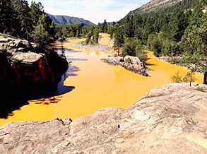
At least one million gallons of mine wastewater was released into Cement Creek and the Animas River when debris blocking the opening to the Gold King Mine gave way as EPA workers tried to excavate the debris to install a pump. The orange-colored water was filled with sediment and heavy metals. The wastewater plume is flowing downstream through Durango, Colorado, and will eventually reach New Mexico and Utah. The city of Durango has stopped pumping water from the river to protect the city reservoir.
EPA began water sampling today to assess the impacts from the mine water. Surface water quality samples were collected from seven locations, two on Cement Creek and five on the Animas River. The EPA selected these locations because an historical data set exists at these locations that will serve as good indicators of conditions before, during, and after the event.