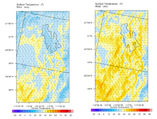
Continued urban growth in the greater Salt Lake City metropolitan area has changed land surface properties and resulted in continued development of an urban canopy over the greater Salt Lake area (GSLA). This canopy refers to impacts on local meteorological conditions due to increased profiles of building structures and anthropogenic heating. These changes in turn impact local pollutant reactions and transport. This is particularly relevant in the GSLA due to the high levels of summertime ozone and wintertime PM2.5 along the Wasatch Front. The influence of existing urban canopies can be observed, but accurate forecasting of weather interactions with urban areas and impacts of future urban growth require predictive modeling. Modeling can be used to fill in measurement gaps and to better understand the correlation between urban growth characteristics, meteorological properties, and ozone and PM2.5 concentrations. Improved understanding of urban growth impacts can inform future growth planning and resulting health impacts.
This two-year project will utilize state-of-the-science meteorological modeling with land use descriptions of the GSLA to characterize impacts of urban growth on local meteorological conditions. These modified ground to atmospheric properties can then be used with state-of-the-science air quality models such as EPA’s Community Multi-scale Air Quality (CMAQ) model to predict ozone and PM2.5 behavior. This project will: 1) develop a current meteorological model of the GSLA which accounts for urban canopy impacts based on publicly available software; 2) use this model to predict impacts on local air temperature, humidity, and wind velocities for changing land use conditions, i.e., urban growth; and 3) document model methodology and usage so air quality modelers can use existing or self-developed future results for additional urban growth and air pollutant assessments.
- Principal Investigator: Bradley Adams (BYU)
- Study Period: July 1, 2020, – December 31, 2021
- Funded by Science for Solutions Research Grant: $59,411
- DAQ Contact: Chris Pennell ([email protected])