
Assessment Tools for GSL Wetlands

Developing methods for assessing the state of Utah’s wetlands has focused on those of Great Salt Lake, which account for approximately 75% of Utah’s total wetland area. To date, probabilistic surveys of two classes of GSL wetlands – impounded and fringe complex wetlands – have been conducted.
Impounded Wetlands
Impounded wetlands represent areas where dikes, berms, ditches and culverts have been constructed to control the inflow and outflow of water through wetlands. These wetlands are often intensively managed and occur as large, shallow ponds that range in size from 20 to over 500 acres. Since 2004 a significant amount of work has gone into the development of a multi-metric index of integrity (MMI) for GSL impounded wetlands. The impounded MMI described in reports below has four components: the condition of submerged aquatic vegetation, the composition of plant-dependent benthic macroinvertebrates, the extent of nuisance algal mats, and water chemistry.
- Survey Report: Impounded Wetland Reference Standard Sites (2015)
- Analysis: 2014 Integrated Report on Wetlands (2014)
- Technical Memo: Impounded Wetlands Validation Report (2014)
- Ecological and Beneficial Use Assessment of Farmington Bay Wetlands
Progress Report to EPA Region VIII by Miller and Hoven (2007) (751 pages)
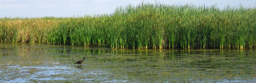
Fringe Wetlands
Fringe wetlands are often (but not always) associated with impounded wetlands, and occur where freshwater flows over very gently sloping portions of the exposed lakebed. Fringe wetlands are often found below the outlets from impounded wetlands, from wastewater treatment facilities, and from other low-gradient surface channels or small streams. The reports below describe potential indicators of fringe wetland condition for a fringe-specific MMI.
- Survey Report: Ecological Characteristics of Great Salt Lake Fringe Wetlands (2016) (8 MB)
- Survey Report: 2013 Great Salt Lake Fringe Wetland Survey (2014) (8 MB)
Current UDWQ Wetland Monitoring and Assessment
Current Wetland Program work has three objectives related to GSL wetlands:
- Deploy sondes with high frequency data loggers at five impounded GSL wetlands where wetland-dependent bird use census data is available.
- Pilot study completed during summer and fall of 2019. Data is currently being processed and SOP’s for 2020 are being revised.
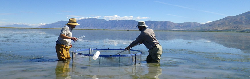
- Conduct a probabilistic survey of 40 impounded GSL wetlands with updated methods and produce a final tool for assessing this wetland class.
- 40 GSL impounded wetlands were surveyed during summer and fall 2019. Data is currently being analyzed in order to update indicators of anthropogenic disturbance and condition. Final assessment tool and reporting is expected in summer 2021.
- Expand monitoring and assessment activities to other wetland classes through a survey of 15 fringe wetlands around GSL using updated, more efficient methods.
- Fringe wetland survey methodology is currently being revised based on a literature review. Sites for the survey will be selected in March 2020.
Willard Spur
The Willard Spur is a large, unimpounded wetland complex located in the Bear River Bay of GSL between Willard Bay and Bear River Migratory Bird Refuge. The Willard Spur Water Quality Study was conducted from 2011 to 2013 in order to determine appropriate and defensible modifications to Utah’s water quality standards to ensure long-term protection of Willard Spur’s aquatic life. In 2019 the Utah State Legislature designated the Willard Spur as a state waterfowl management area (WMA). The Utah Division of Wildlife Resources is in the process of developing a management plan for the new WMA. The reports below summarize the Willard Spur study results and the results of Conservation Action Planning meetings held in support of Willard Spur.
- Willard Spur Water Quality Standards Workshop (2018) (1 MB)
- Willard Spur Summary (2018) (1 MB)
- Willard Spur Open Water Conditions (2015) (13 MB)
Sampling and Analysis Plans
- Wetland Monitoring 2019-2020 SAP (2019)
- Great Salt Lake Basin Reference Standard Sites SAP (2014)
- Fringe Wetlands SAP (2013)
- Impounded Wetlands SAP (2012)
Standard Operating Procedures
- Filtering of Chlorophyll-a Samples (09/09/11)
- Calibration, Maintenance, and Use of Hydrolab Multiprobes (09/09/11)
- Collection of Macroinvertebrates in Wetlands (09/09/11)
- Collection of Water Chemistry Samples (09/10/11)
- Collection of Zooplankton Samples Using a Horizontal Tow (09/09/11)
- Determining Percent Cover of Aquatic Vegetation in Wetlands (09/09/11)
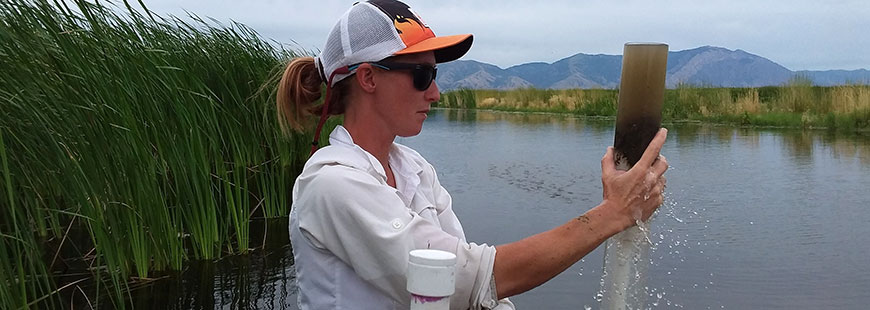
- Sediment Samples in Wetlands (09/10/11)
- SOPs for Analysis of Aquatic Macroinvertebrate Sample Collected from the Great Salt Lake Freshwater Wetlands (07/2009)
Previous Work on Wetland Assessment
- Development of an Assessment Framework for Impounded Wetlands of Great Salt Lake
UDWQ (2009) (98 pages; 2.7 MB) - Macroinvertebrates in the Wetlands of the Great Salt Lake
Gray (2007) (89 pages; 0.4 MB)