Aquifer Classification Process
When sufficient information is available, entire aquifers or parts of aquifers may be classified or reclassified by the Utah Water Quality Board according to ground water quality of the aquifer.
Petition Requirements
Any person may petition the Water Quality Board for classification of an aquifer, and the petition must include the following information:
- Factual data supporting the proposed classification;
- A description of the proposed ground waters to be classified or reclassified;
- Potential contamination sources;
- Ground water flow direction;
- Current beneficial uses of the ground water; and
- Location of all water wells in the area to be classified or reclassified.
Parts of an aquifer may be classified differently. Boundaries between different ground water class areas will be based on hydrogeologic properties, existing ground water quality data, and for Class IB and IC, current use of the ground water. For definitions of different ground water classes, please refer to the tab GW Classes and Protection Levels.
A petition for classification or reclassification must be performed under the direction, and bear the seal, of a professional engineer or professional geologist.
The petitioner requesting reclassification will provide sufficient information to determine if reclassification is in the best interest of the beneficial users.
Public Comment
After a technical review of the petition has been conducted by the Division of Water Quality, one or more public hearings will be held to receive comment on classification and reclassification proposals.
Planning Tool
Ground water classifications are intended to be used as a planning tool by local governmental agencies. Ground water classifications do not mandate any specific actions for local planning and zoning, nor obligate local governments to perform any technical assessments or monitoring, nor restrict existing or future land use.
Classified Aquifers
Following are maps of aquifers that have been classified by the Board.
Click photo to see larger version (Warning: large download sizes).
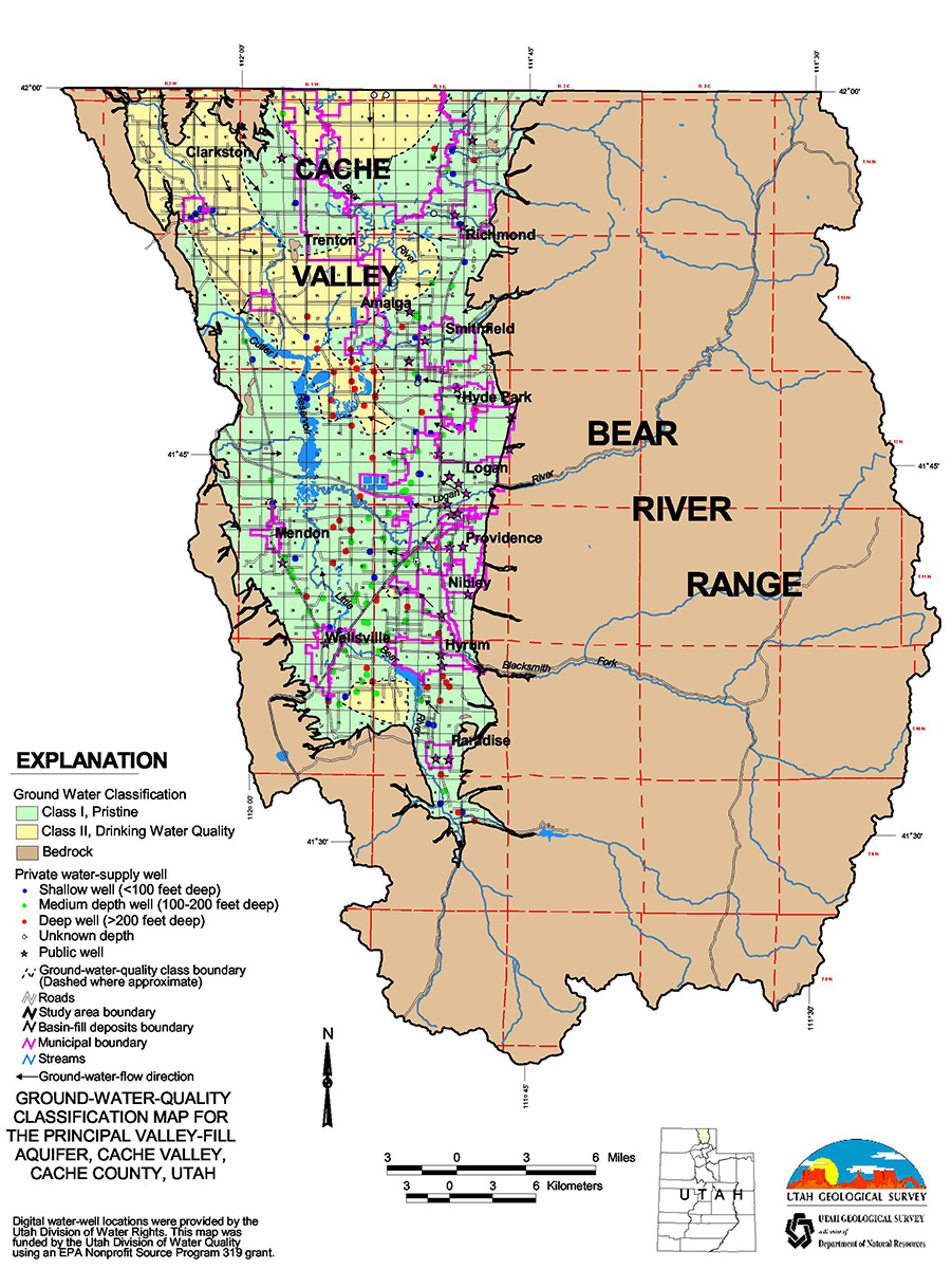
Cache Valley
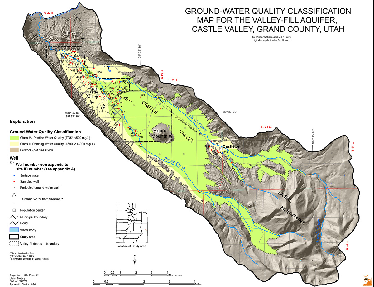
Castle Valley
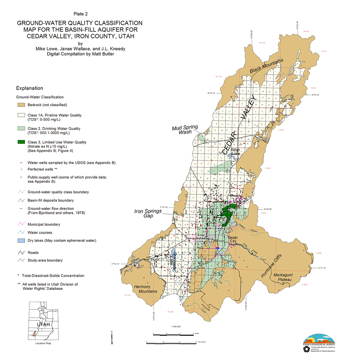
Cedar Valley
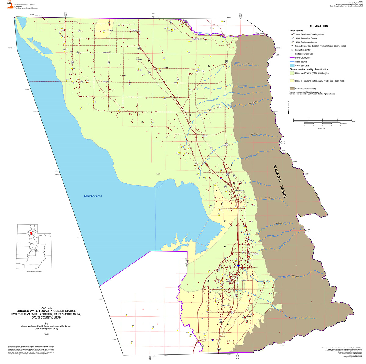
Davis County
- Aquifer Classification Petition Document
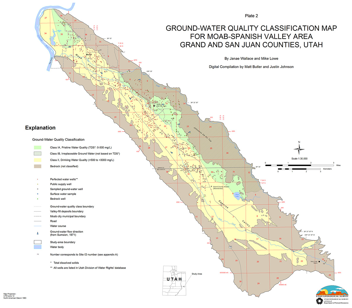
Moab-Spanish Valley
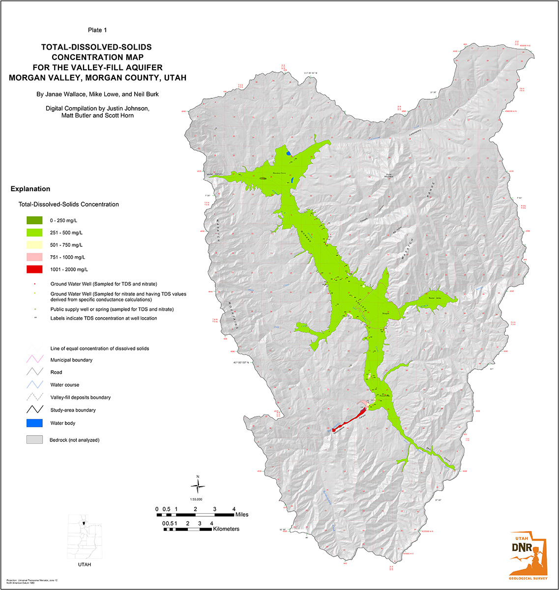
Morgan Valley, Plate 1
- Aquifer Classification Petition Document
Morgan Valley, Plate 2

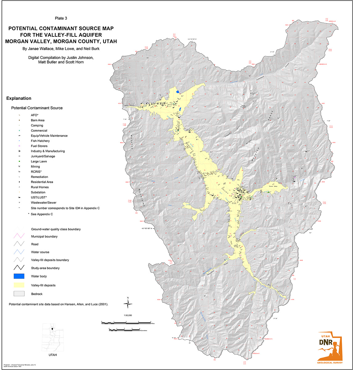
Morgan Valley, Plate 3
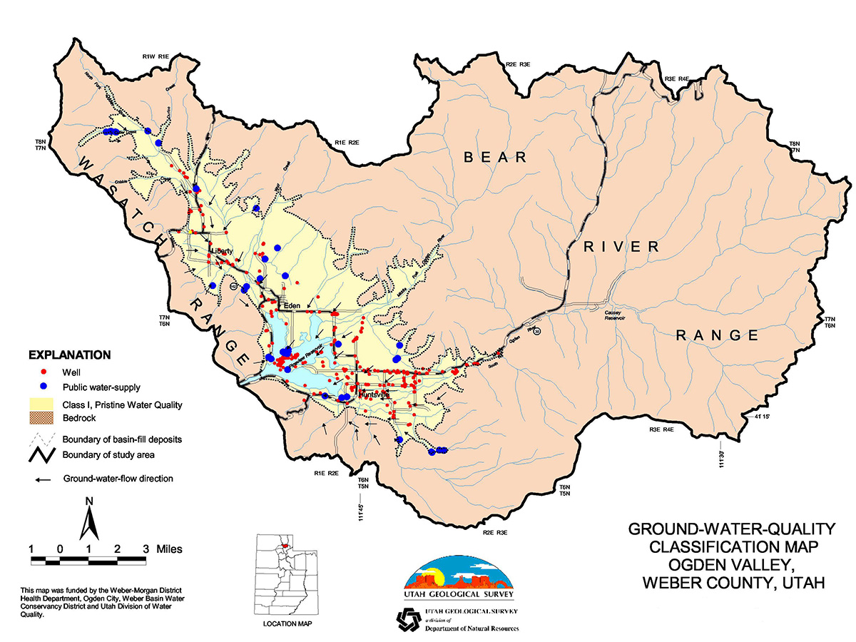
Ogden Valley
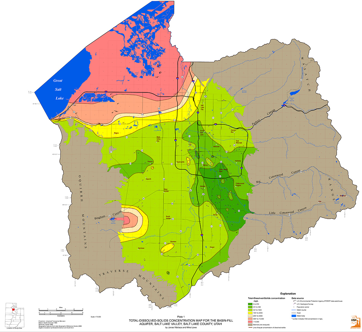
Salt Lake Valley, Plate 1
- Aquifer Classification Petition Document
- Aquifer Classification Petition Document: Appendix B
- Public Participation Document
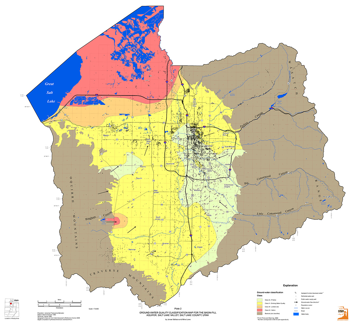
Salt Lake Valley, Plate 2
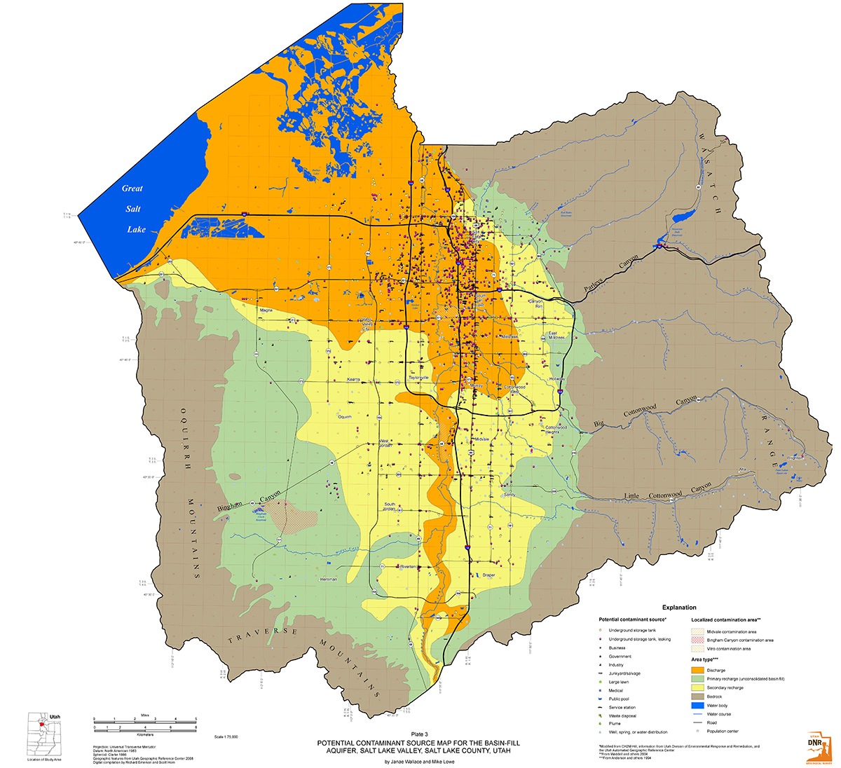
Salt Lake Valley, Plate 3
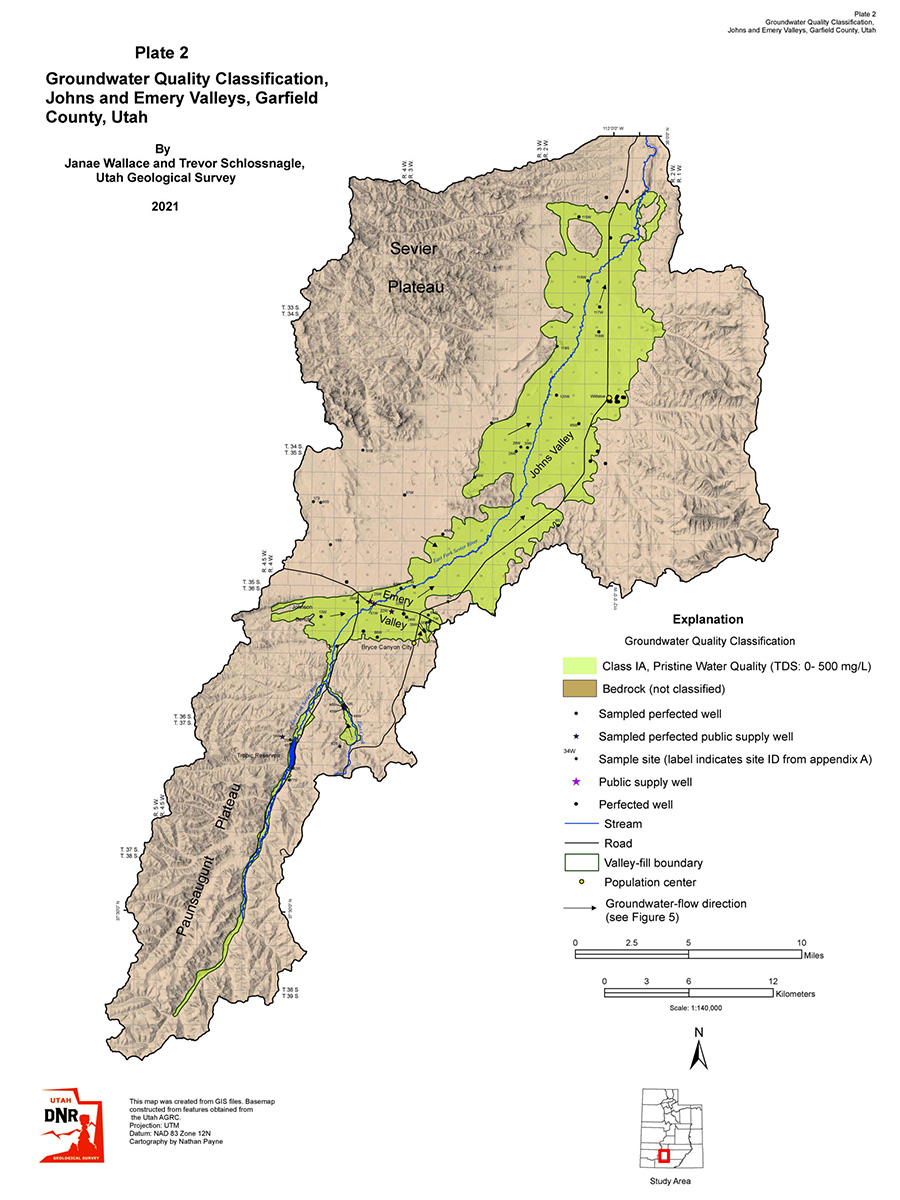
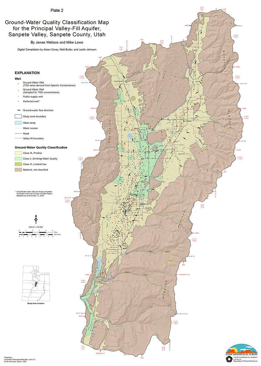
Sanpete Valley, Plate 2
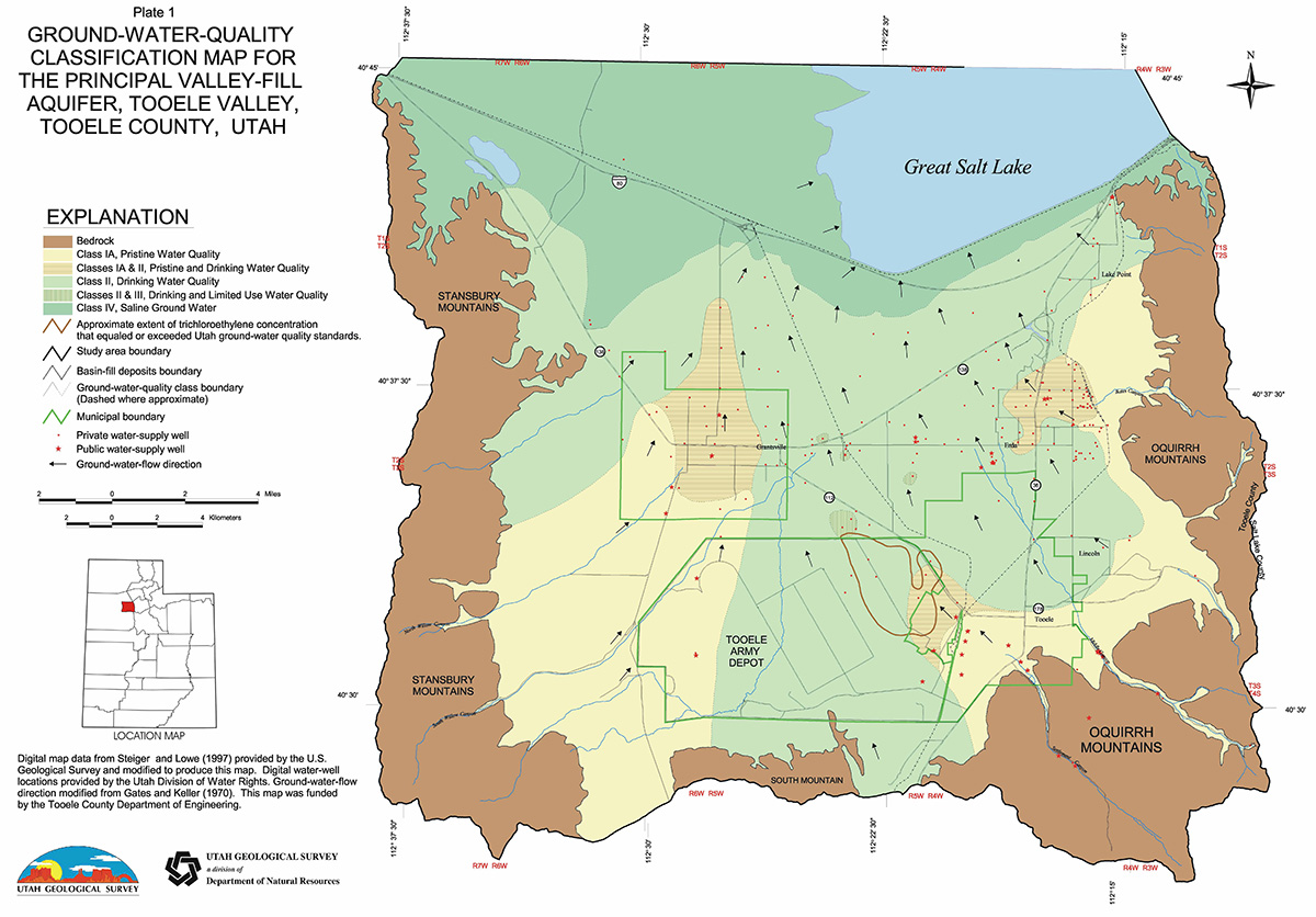
Tooele Valley
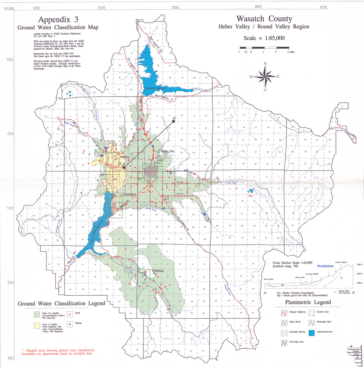
Wasatch County
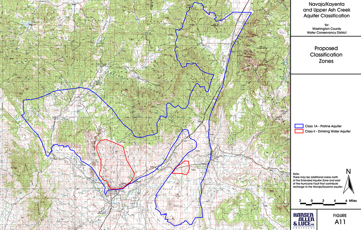
Washington County