Watershed delivery of flow and nutrient loading to Utah Lake are important for understanding how nutrients are processed in the lake and the resulting water quality of the lake. Simulations of in-lake water-quality conditions will use a series of in-lake water-quality and hydrodynamic models (EFDC and WASP). Since these models do not explicitly simulate delivery of flow and loading from the watershed to the lake, these parameters must be set as a boundary condition, meaning that inputs to the lake will be characterized outside of the in-lake model framework.
A number of techniques can be employed to estimate load and flow delivery to the lake, including the characterization of monitoring data, simulation of watershed conditions with watershed-scale models, paired watershed statistical analyses, or some combination of these techniques. The Utah Lake Pollutant Load Assessment Report presented a reasonable analysis of flow and total phosphorus (TP) load entering the lake through tributaries, precipitation, canals, springs, and other significant sources.
During Phase 1 of the Utah Lake Water Quality Study, DWQ characterized current flow and loading conditions to Utah Lake and highlighted a number of data gaps and assumptions to be addressed through future monitoring and evaluation.
Deliverables
- A water and nutrient budget to support the model build and calibration when possible
- Updated water-budget and flow data for Utah Lake and tributaries.
- Loading analysis to identify and quantify the watershed sources of pollutants.
- Pollutant loads calculations apportioned to each source
- An estimated watershed-wide water budget
- Load summary by season and hydrologic condition including spring runoff, wet weather, and dry weather
Accomplishments
The Division of Water Quality (DWQ) compiled, reviewed, and analyzed new data collected since the 2007 analysis on nutrient loading conducted by Psomas and updated the loading analysis to incorporate a broader set of hydrologic conditions and nonpoint sources. The revised analysis is based on the most recent water-quality and hydrologic data available for tributaries to Utah Lake, as well as Discharge Monitoring Report (DMR) data available for each of the publicly owned treatment works (POTWs). DWQ calculated important statistical measures such as minimum and maximum values, mean, median, and variance. Seasonal and trend analyses were completed to identify seasonal variation in the pollutants of concern and long-term water-quality trends.
Water Budget
A water budget–the accounting of all inflows and outflows for a hydrologic system–is a foundational product for estimating nutrient loading to Utah Lake. Existing water budgets were evaluated in the Utah Lake Pollutant Load Assessment Report. The Water Budget Data Characterization and sections below discuss ongoing efforts to improve the characterization of the Utah Lake water budget, which will lead to an improved understanding of nutrient loads delivered to the lake.
Direct Drainage and Ungaged Tributaries
DWQ differentiated watershed areas that flow into major tributaries from those areas that flow directly to Utah Lake. Although direct drainage areas comprise only 8% of the total watershed area, they make up the majority of the lake shoreline and are an important component to the total nutrient loading to the lake with respect to irrigation return flows, stormwater discharges, groundwater drainage, and nutrients deposited below the lake’s high water line. However, most monitoring locations are representative of tributary watershed areas, with few monitoring locations within direct drainage and no monitoring locations along the base of Lake Mountain, Goshen Bay and West Mountain due to difficult access and lack of perennial flows. DWQ and the Utah Lake Watershed Coordinator are taking inventory of canals, drains, streams, and other channel types to guide future monitoring and characterize direct drainage nutrient contributions.
Median water-quality concentrations for each tributary were calculated separately for each of the four hydrologic periods. Median water-quality data associated with each hydrologic condition were paired with daily flow values for each tributary to develop a more refined loading analysis for phosphorus and nitrogen into Utah Lake. These load analyses will be a primary input to the Utah Lake water-quality model. In addition to tributary loads, DWQ will use data from wastewater treatment plants that discharge into Utah Lake or its tributaries to parse the proportion of the total load that is associated with point-source discharges. DWQ also developed a method to estimate the nutrient load that runs off directly to the lake rather than through a tributary or wastewater discharge.
Utah Lake Inflows
To characterize Utah Lake inputs, DWQ identified verified, permitted, and potential sources and linked them to a visual map and high-quality data to characterize Utah Lake inputs. Some of the inputs and outfalls were documented and mapped by local cities, municipalities, and service districts but many natural and man-made perennial inputs are not monitored for flow. Local resource managers, including city water managers, canal and irrigation companies, and individual landowners were contacted for information to help identify potential inputs not currently sampled by DWQ.
Information gathered during field visits at potential inflow sites was evaluated with other sources of resource information, including digital imagery, municipal outfall location maps, current watershed sampling locations, and verbal insights from land managers, agricultural producers, and water managers around Utah Lake. The comparisons and mapping exercise led to the identification of 20 sites that contribute a significant amount of largely unmonitored water into the lake.
Previously Developed Water Budgets
The Utah Lake Water Quality Salinity Model (LKSIM) model developed by Dr. LaVere Merritt was used in a 2008 study of pollutant loading titled Utah Lake TMDL: Pollutant Load Assess & and Designated Use Impairment. The strength of LKSIM is that it estimates monthly discharge volume for all inflows to the lake using available streamflow and precipitation data and estimates groundwater and spring contributions by balancing ion concentrations in the lake.
There are some limitations, however, to using the LKSIM water budget for estimating the total nutrient load delivered to the lake:
- LKSIM does not account for some potentially significant hydrologic contributions like stormwater or event-driven discharge events.
- LKSIM estimates are based on average monthly conditions that may not accurately characterize episodic precipitation and runoff events.
- Discharge volumes for tributaries without flow data are estimated by statistical comparison to paired watersheds with available data.
The LKSIM analysis is suited for estimating average monthly discharge volumes for tributary and subsurface water delivery but is limited in its use for evaluating tributaries independently and accounting for the unique hydrologic qualities of each. Additionally, the averaging period used in LKSIM does not allow evaluation of event-driven loading events such as significant runoff or drought conditions.
Other hydrologic analyses have been conducted previously on Utah Lake, primarily for the purpose of water-management activities associated with the Central Utah Project and management of downstream water rights. These include the State Water Plan for Utah Lake Basin (44 MB), the Utah Lake System EIS, and the Utah Lake Comprehensive Management Plan. While these analyses are useful for water management of Utah Lake, they are not of sufficient resolution for use in estimating nutrient loading and are not considered further in this report.
To improve the LKSIM water budget, DWQ recommends the establishment of high-frequency monitoring stations on significant tributaries. The produced dataset will improve site-specific understanding of flow conditions, account for unique water management activities more accurately in each, and provide finer temporal resolution to better characterize dynamic hydrologic conditions.
Water Budget Data Characterization
Flow information for the Utah Lake watershed includes discrete “grab sample” measurements and continuous-flow measurements. Grab sample, or instantaneous flow measurements, are usually recorded when water samples for laboratory analysis are collected. These instantaneous flow measurements represent flow conditions at a specific point in time. Real-time flow measurements, otherwise known as continuous flow, are collected by a high-frequency monitoring device capable of providing hourly or daily flow values.
DWQ evaluated locations and sample frequency for instantaneous and continuous flow measurements in proximity to Utah Lake. Based on guidance from stakeholders, monitoring locations were evaluated for representativeness of upstream land uses and their ability to characterize loading and flow conditions for watersheds with limited data and information.
Instantaneous Flow
The primary source of instantaneous flow data for Utah Lake tributaries is available from the DWQ Ambient Water Quality Monitoring System database (AWQMS) and was provided by a number of partner agencies during sampling of water-quality chemistry parameters. More than 400 historic and current monitoring locations exist in the Utah Lake watershed. DWQ and partners implemented a monitoring plan in 2017 of all major tributary watersheds around the lake.
Continuous Flow
The primary source of instantaneous flow data for Utah Lake tributaries is available from the DWQ Ambient Water Quality Monitoring System database (AWQMS) and was provided by a number of partner agencies during sampling of water-quality chemistry parameters. More than 400 historic and current monitoring locations exist in the Utah Lake watershed. DWQ and partners implemented a monitoring plan in 2017 of all major tributary watersheds around the lake.
The U.S. Geological Survey (USGS) maintains most of the continuous flow monitoring stations surrounding Utah Lake, including three significant tributaries:
- Provo River
- Hobble Creek
- Spanish Fork River
Data available for each location includes hourly flow and stage measurements as well as average daily flow. However, the Spanish Fork river location was discontinued in 1988 and is no longer active. A second USGS gage on the Spanish Fork River, located near Castilla, Utah, is above the mouth of Spanish Fork Canyon and the diversion to the Strawberry Highline Canal system. This location cannot be used to estimate flow volume delivered to the lake but is evaluated to understand the timing, duration, and intensity of hydrologic events within this watershed area.
Pressure Transducer Monitoring of Continuous Flow
DWQ installed a network of continuous-flow monitoring-pressure transducer stations in 2017 to supplement the USGS continuous flow network and instantaneous monitoring stations. Transducers are programmed to record water depth, pressure, and water temperature at 15-minute intervals. To determine discharge, a relationship between flow and water depth is developed by pairing readings of measured instantaneous flow with the corresponding measurement of stage recorded on the pressure transducer. These paired measurements are then plotted to develop a discharge rating curve. Once a statistically significant relationship is developed, pressure transducer stage measurements can be used to determine discharge at frequent time steps. For the pressure transducers located around Utah Lake, discharge is measured at a 15-minute interval, which greatly improves data resolution over instantaneous flow values.
Instantaneous Flow
The primary source of instantaneous flow data for Utah Lake tributaries is available from the DWQ Ambient Water Quality Monitoring System database (AWQMS) and was provided by a number of partner agencies during sampling of water-quality chemistry parameters. More than 400 historic and current monitoring locations exist in the Utah Lake watershed. DWQ and partners implemented a monitoring plan in 2017 of all major tributary watersheds around the lake.
Bulk Nutrient Loading
Utah Lake Pollutant Load Assessment Report
The Utah Lake TMDL: Pollutant Loading Assessment Report presents the most current nutrient loading assessment for the lake. This analysis first estimates the total water budget to the lake from all major flow contributions including major tributaries, precipitation, springs, groundwater, and publicly owned treatment works (POTWs) using the previously discussed LKSIM water budget. Second, average nutrient concentrations were calculated based on existing water chemistry data for each flow contribution type. Finally, flow and concentration data and the appropriate conversion factors were combined to produce the estimated total nutrient load to the lake.
This analysis uses the LKSIM water budget as a foundation, which allows for estimating nutrient loading from all sources contributing water to the lake. This approach also reasonably characterizes average monthly nutrient loads from each of these sources. There are, however, several limitations and assumptions to this approach being considered in ongoing monitoring and research efforts:
- Load estimates represent average monthly conditions and do not account for the influence of significant hydrologic events like drought, extreme high- and low-flow events, precipitation-driven events, and other significant hydrologic factors.
- Monitoring locations for some tributaries do not represent conditions at the location where the tributary enters the lake. This may not account for nutrient cycling within the stream, localized land-management activities, and major hydrologic changes occurring near the lake.
- Sources originating in direct drainage watersheds like stormwater runoff and agricultural irrigation return flow are not well characterized. Estimates for these sources are incorporated in the load analysis since all sources of water are characterized and assigned an average concentration. However, stormwater and agricultural sources are highly influenced by discrete hydrologic events, and the method used in this analysis likely does not accurately characterize them
- The LKSIM water budget model doesn’t account for nutrient loads delivered directly to the lake from land management activities below the high water line, ungaged tributaries, and atmospheric deposition.
These considerations were generated by stakeholders at the beginning of the Phase 1 effort and are being addressed by ongoing monitoring, research, and watershed modeling efforts being conducted by DWQ, University of Utah, and other partner entities.
Loading Data Characterization
Paired samples of flow and nutrient concentrations are required to calculate loading at a sampling location. It is important to note that flow data is not always available for a given water chemistry sample, prohibiting the calculation of load for that respective sample. To ensure consistency with the ongoing water-quality modeling effort being conducted by the University of Utah, this discussion will focus on data collected from 2005 to present.
The data were predominantly collected by DWQ, the Wasatch Front Water Quality Council (WFWQC), and BYU with the express purpose of characterizing inflow conditions. However, much of the data collected in 2016 is flagged for quality-control purposes:
- Data collected by the WFWQC are flagged as provisional and incomplete. Some locations show a sample count of zero for flow data because the data were not received by DWQ. Additionally, 2017 data were not submitted to DWQ for inclusion in this analysis.
- DWQ from 2016 and 2017 samples represent provisional samples until they undergo QA/QC analysis.
Generally, there is a good amount of nitrogen and phosphorus data available for updating load estimates to the lake. Larger tributaries such as the Provo River, Spanish Fork River, Hobble Creek, Benjamin Slough, American Fork River, and Powell Slough have good data richness, while others have limited data since they only began to be sampled recently.
The ongoing University of Utah modeling effort and a series of watershed models will be linked to generate nutrient loads delivered to the lake. The model framework will be calibrated to the period of 2005 to 2015 while incorporating new data for validation and improving model performance.
Monitoring locations within the Utah Lake watershed were reviewed to identify locations that accurately reflect conditions as tributaries enter the lake. Lindon Drain, Powell Slough North, Mill Race, and Dry Creek (Provo Bay) have relatively high Total Phosphorus (TP) loads as compared to smaller tributaries like the American Fork River, Powell Slough South, and Hobble Creek. The Provo River and Spanish Fork River deliver a combined 60 percent of inflows to Utah Lake; however, they deliver a relatively low TP load given their large flow contribution.
The Total Nitrogen (TN) dataset does not have as many samples as TP because the capability to analyze for TN is relatively new. TN was added to the Utah Lake monitoring program in 2017 and is sampled monthly along with TP. These data will be utilized by the University of Utah to characterize nutrient inputs to the lake and calibrate a series of water-quality models.
Watershed Model Development
University of Utah Modeling Project
A multi-disciplinary research team from the University of Utah is in the process of building, calibrating and analyzing several coupled models of the Jordan River-Utah Lake watershed. The hydrology and water temperature of the non-urbanized, mountainous portion of the watershed will be simulated using the Distributed Hydrology Soil Vegetation Model (DHSVM) maintained and distributed by the University of Washington and the Pacific Northwest National Laboratory. DHSVM does not currently have the ability to simulate nutrient loading from the watershed. The hydrology and water quality of the urbanized portion of the watershed along the Wasatch Front will be simulated using the Stormwater Management Model (SWMM) maintained and distributed by EPA. In addition, water demand, depletion, wastewater discharge, and return flows of the urban systems will be simulated using GoldSim, which is maintained and distributed by the GoldSim Technology Group.
Watershed Model Selection
Future selection of watershed models to support nutrient loading analysis and wasteload allocations will involve stakeholders. All available options and models will be reviewed prior to selection of a watershed model. Some or all of the models being developed by the University of Utah research team, including with or without modification and recalibration, may be selected. However, a watershed model on an entirely different platform may be selected and developed, depending on the objectives and required output of the nutrient loading analysis.
Watershed Source Identification
Nutrient bulk loads to Utah Lake are comprised of tributaries and direct drainages to the lake. These loads are important for understanding in-lake nutrient cycling and identifying watershed nutrient sources necessary to guide future implementation strategies. The Utah Lake Water Quality Study Steering Committee has committed to addressing source identification to determine feasible approaches for meeting in-lake goals and implementing effective watershed-management approaches.
Understanding the magnitude, frequency, duration, and seasonal variability of nutrient load delivery to Utah Lake in response to a wide range of hydrologic and climatic conditions is important, as well as understanding where the nutrients originated.
Watershed Metadata Analysis
Typical approaches for conducting a watershed source identification analysis include intensive monitoring and field inventories, characterization of water quality, and application of watershed-scale models. Each approach has different data requirements, and understanding them is the first step to selecting a viable approach. The selected approach should be matched to the information available through a metadata analysis that identifies limitations of the dataset, data gaps, and helps inform future monitoring programs.
The first step of a metadata analysis is to inventory datasets useful for watershed source identification. The types of data typically needed to complete a watershed modeling effort or a comprehensive source assessment fall into four general categories:
- Geographic/locational information
- Monitoring data
- Land practices and activities
- Other information
Utah Lake Source Characterization
Potential nutrient sources in the Utah Lake watershed include background, or natural, sources that are not influenced by land use and water management activities including groundwater, springs, natural erosion, and natural atmospheric deposition. Anthropogenic, or human-caused, sources of nutrients are introduced by land- and water-management activities and include stormwater runoff, point-source discharges, agricultural land management, streambank and land erosion, and atmospheric deposition from human sources.
Hydrologic Influence on Loading
Hydrologic conditions can significantly affect timing, magnitude, and duration of nutrient loads delivered to Utah Lake from the surrounding watershed. Precipitation-driven sources like upland and streambank erosion are examples. During high-flow events, erosion is more likely and therefore more likely to transport loading to the lake. During low-flow and base-flow conditions, nutrient sources will be conveyed differently than during high flows.
The first step in determining hydrologic influences on source delivery is to evaluate the hydrograph for the location of interest and determine if water-quality sampling is representative of all flow conditions. The Hobble Creek location shows good temporal distribution for the active sampling period of the USGS gage, with water-quality samples collected at high-flow events, low-flow events, and mid-range flow conditions. A similar observation can be made at the Provo River location; however, water-quality monitoring began in 2016 and water-chemistry data is not available for a period sufficient to represent all flow regimes.
The Provo River and Hobble Creek sites are the only two sampling locations representing lake inflow conditions with continuous USGS flow measurements and a similar comparison cannot be made at other stations. DWQ has installed continuous-pressure transducer monitoring stations at all inflow tributaries to develop a dataset for inflow conditions.
Characterization of Magnitude/Duration/Timing
Further investigation of flow conditions frequency allows empirical evaluation of water-quality samples and the flow conditions they represent. A flow-frequency curve is a distribution of flow values ranked from highest to lowest and presented as a percentage of the entire data record flow exceeding an individual value.
Flow exceedance curves can be further modified to represent loading conditions. For the purpose of TP, USGS flow was multiplied by DWQ’s stream nutrient indicator value to develop a load-capacity curve. Plotting observed TP load over this curve shows that water quality samples are well distributed for most flow regimes. However, sample frequency is not sufficient to accurately characterize loading within each flow regime. For example, only seven samples represent flows between 20 percent and 60 percent. To develop a significant relationship of loading and flow, 30 or more samples are recommended for each 10- to 20-percent flow interval. Additionally, continuous-flow data do not exist to do these analyses at all tributary locations. It is recommended to continue developing continuous-flow datasets to help accurately target water-quality sampling efforts.
Stormwater
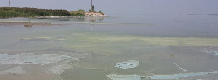
Nutrient loading from stormwater runoff is not well characterized in the Utah Lake watershed and is suspected to contribute significantly to the lake’s nutrient budget. However, there is no known or readily available information to characterize flow and water quality associated with this source in Utah County.
Utah Lake Watershed Land Uses
Land use characteristics for the Utah Lake watershed from the Multi-Resolution Land Characterization dataset (MRLC) were used to identify urban and residential landscapes contributing to stormwater runoff. For the purpose of this analysis, the watershed was delineated to exclude the Provo River above Deer Creek Reservoir and all transbasin diversions from the Weber River and Strawberry River watersheds. Land uses that have potential to contribute stormwater include developed high intensity, developed low intensity, developed medium intensity, and developed open space, which make up approximately seven percent of the total watershed area.
Four methodologies can be used to calculate the estimated annual Total Phosphorus (TP) load to Utah Lake attributed to stormwater runoff from developed areas:
- Loading coefficients
- Average runoff (curve number method)
- Stormwater load
- Simple Method using average annual rainfall and Salt Lake County monitoring data
Using these four methods, the calculated TP stormwater load from the developed portion of Utah Lakeload is 6-27 tons per year. The estimated TP contribution from the publicly owned treatment works (POTWs) to Utah Lake is 270 tons per year. Based on these estimates, the stormwater contribution to the lake is 2-10 percent of the POTW contribution.